
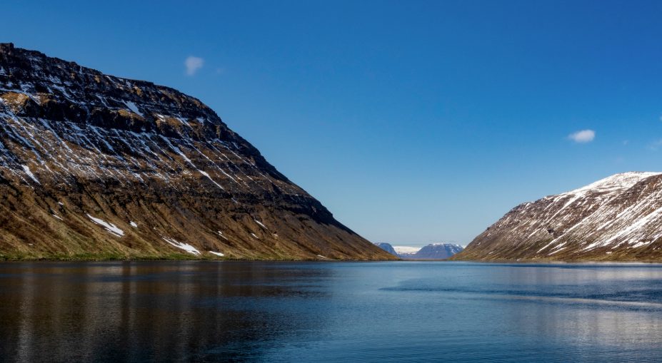
Driving around the Westfjords is one of the highlights of Iceland. There you’ll find almost everything Iceland has to offer: quaint villages, high mountains, charming puffins, deep fjords, natural hot springs, and beautiful waterfalls, to name a few. This guide covers the full counterclockwise route, the ferry shortcut, what to drive, and where to camp along the way.
Ferry vs. Driving — Which Should You Choose?
Before you commit to a route, decide how you want to experience the Westfjords: drive the full counterclockwise loop, or shorten the trip with the Baldur ferry from Stykkishólmur on the Snæfellsnes Peninsula to Brjánslækur.
The ferry runs year-round, not just in summer — a detail worth knowing because a lot of trip-planning content gets this wrong. From June through August it sails twice daily each way; the rest of the year it drops to fewer daily crossings. You need to pre-book a spot for your camper van. Walking on with a vehicle isn’t an option.
| Full Loop | Ferry Shortcut | |
| Distance | ~877 km (545 miles) | Skips roughly one leg of the drive |
| Time | 13+ hours non-stop | ~2.5 hour crossing, plus driving on either side |
| What you see | Both sides of the Westfjords | One side, with more time elsewhere |
| Booking | No pre-booking needed | Camper van spot must be pre-booked |
If you’re short on days or you’ve already spent time on the Ring Road and want to add the Westfjords without doubling back on yourself, the ferry is the practical choice. If you have the time, the full loop shows you sides of the region — Ísafjörður, Strandir, the northern fjords — that the ferry route skips entirely.
For the current sailing times, prices, and how to book your camper a spot, read our full ferry schedule and booking details.
Weighing up your route options? Compare camper options for this trip and see what fits your group size and the days you have.
Do You Need a 4×4 for the Westfjords?
Here’s the direct answer: for the main Westfjords loop — Route 60, Route 62, and the connecting roads through Ísafjarðardjúp — most of the driving is gravel and mountain-pass, not F-road. A standard 2WD camper van is workable for most travelers in summer.
That’s a different situation from the Highlands or Landmannalaugar, where 4×4 isn’t a suggestion, it’s a hard requirement enforced by river crossings and road closures. The Westfjords loop doesn’t have that gate. It’s rougher than the Ring Road, but it’s built for regular traffic.
Where 4×4 capability genuinely helps:
Winter and shoulder-season travel: Snowfall and rapid weather changes on the Westfjords’ mountain passes make extra traction worth having once summer ends.
Side roads that aren’t part of the main loop: Road 633 near Ísafjarðardjúp, for example, is most likely closed in winter and better suited to a 4×4 even when it’s open.
The descent to Rauðisandur: The road down is steep, with 180-degree turns. It’s safe to drive in a standard vehicle, but a 4×4 adds confidence on that stretch.
If you’re deciding on a vehicle for your whole Iceland trip rather than just this route, our guide on choosing between 2WD and 4×4 camper vans breaks down the decision in more depth.
Want extra confidence on the unpaved sections? View our 4×4 camper range and see what’s available for your dates.
Driving the Counterclockwise Loop
If you were to drive the Westfjords in a counterclockwise direction, you would start by taking the Ring Road straight north, all the way to a gas station/rest stop called Staðarskáli. It’s a 2-hour drive from Reykjavík (164 km/102 miles) on a paved road to the gas station.
Take an immediate left when you leave the gas station. If you pass the bridge, you’ve driven too far; you’ll be on the west side of the fjord north of you.
From Staðarskáli to Hólmavík, it’s 110 km (68 miles) and takes about an hour and a half without stopping. The route is called Strandir, which translates to ‘beaches’. Stop at any beach along here, and you’re likely to see driftwood that’s traveled all the way from Siberia.
Hólmavík
The village of Hólmavík and its surroundings have quite a bit to offer, including a great campsite in the middle of town and a swimming pool right next to it. The pool isn’t geothermally heated, but it still has hot tubs.
You’re within walking distance of the Museum of Icelandic Sorcery & Witchcraft, a genuine must-see while you’re in the area — you’ll find out what Necropants are.
Drive north from Hólmavík for about 10 km (6 miles), and you’ll reach a crossroads. You can continue on the road you’re on, or take a right for a detour that loops back to the same junction.
Steingrímsfjarðarheiði & Ísafjarðardjúp
After about 36 km (22 miles) across the mountain pass Steingrímsfjarðarheiði, a whole new world opens up. You’ve reached Ísafjarðardjúpið, a huge fjord made of many smaller, deeper fjords. You’ll pass nine different fjords before reaching Ísafjörður, the capital of the Westfjords.
Before the drive, consider a dip in Nauteyrarlaug, a small hot spring that’s rarely busy. At the first fjord, heading north, you have a choice: turn right at the crossroads to drive around the peninsula on road 633 — but check road conditions first, since it’s typically closed in winter.
Súðavík
You have four fjords to drive through here, with nothing but stunning nature and incredible views. It’s about 130 km (81 miles) to Súðavík, now split into old and new sections after a 1995 avalanche that killed 14 people and forced the village to relocate further into the fjord. The old part is only used in summer.
Continue on the other side of the peninsula, and you’ll reach Ísafjörður, the largest town in the Westfjords.
Ísafjörður & Surroundings
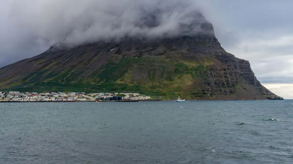
Ísafjörður has too many interesting places to list here. If time allows, take a boat trip to the northern tip of the Westfjords — a stunning, roadless destination with just the occasional house, like the one at Hesteyri. You can do a day trip or arrange to be dropped off and picked up later.
North of Ísafjörður you’ll find Bolungarvík and Hnífsdalur, both worth a stop. Just outside town, you can hike Bolafjall — a road leads to an old radar station, with a view that’s worth the climb on a clear day.
Driving South from Ísafjörður
Continuing south, you’ll drive through a tunnel with a crossroads inside it. A right turn takes you to Suðureyri, a small, picturesque village well off the main track. Straight through the tunnel brings you to the next fjord, where a right turn before the bridge takes you to Flateyri — a village turning into a hip escape for city dwellers as old houses get renovated.
Continuing South to Þingeyri
After the next mountain pass and fjord, you’ll reach another crossroads. Turn left to continue, or head straight for about a minute to Þingeyri, home to Simbahöllin — a charming coffee shop that doubles as the village hub for local tours and campsite information. It’s worth a visit for the art focus and artist residencies alone.
Dynjandi and the South Westfjords
From Þingeyri, Bíldudalur is a 95 km (59-mile) drive, or shorter if you take a left at the crossroads to visit the Icelandic Sea Monster Museum first.
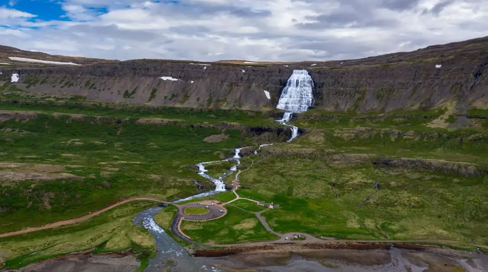
Don’t miss Dynjandi on your way south. It’s the largest waterfall in the Westfjords: a cascading system of seven tiers dropping around 100 meters, spreading from 30 meters wide at the top to 60 meters at the base as it fans out — the shape that gives it its nickname, the “bridal veil of the Westfjords.” It carries 800 monthly searches on its own, which tells you how much of a draw it is; plan real time here, not a five-minute photo stop.
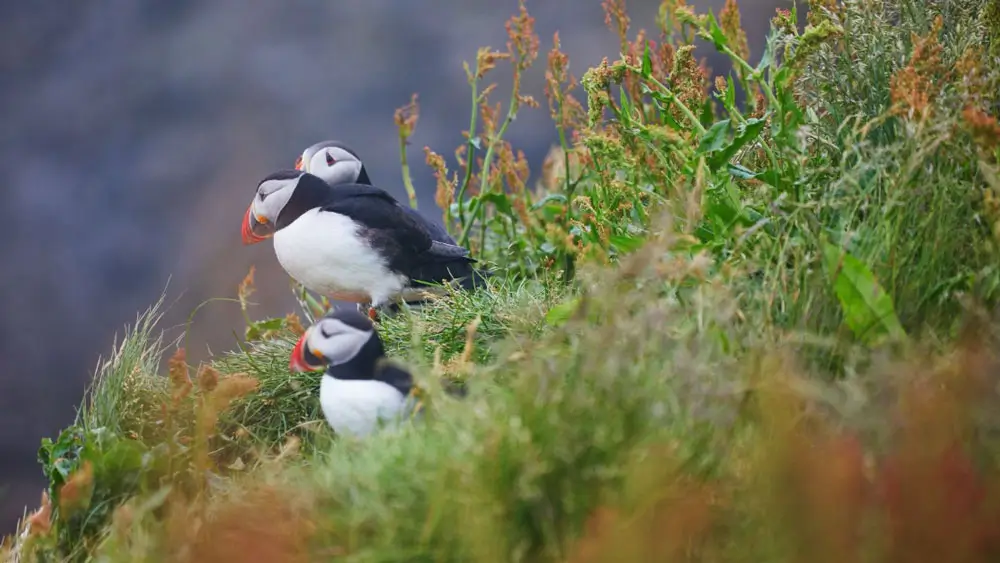
Depending on your schedule, plan to reach Látrabjarg, Europe’s westernmost point. The cliffs here run 14 km (8.7 miles) long and rise up to 440 meters — Europe’s largest bird cliff, and one of the most striking. You’ll find dramatic drops, big waves below, and puffins if the season is right.
The remaining villages on this side — Bíldudalur, Tálknafjörður, and Patreksfjörður — all have campsites. Patreksfjörður sits closest to Látrabjarg, making it the convenient base for an early start. It’s difficult to recommend one village over the others.
Bíldudalur
If you spend time in Bíldudalur, drive further north on the peninsula to Selárdalur to see where the artist Samúel Jónsson lived and worked. It’s about 21 km (13 miles) to the museum, open only June 10 to August 21, with a small entry fee — worth the detour for something genuinely out of the ordinary.
If you’re camping in Patreksfjörður, the drive to Látrabjarg is 134 km (83 miles) and takes about 2.5 hours. About halfway there, you’ll pass the Hnjótur museum, home to Iceland’s second surviving DC-3 aircraft.
Beyond the museum, you’ll arrive in Breiðavík, home to your last campsite on this route — a lovely spot right by the ocean.
South Westfjords and Rauðisandur
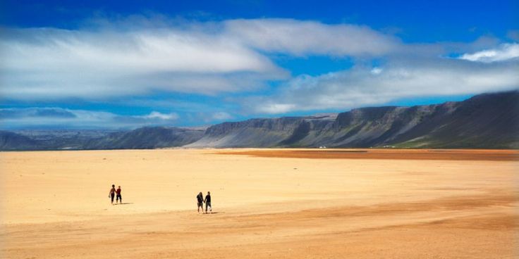
After Látrabjarg, the south side of the Westfjords still has plenty to offer. One highlight is Rauðisandur beach. Take a left at the crossroads to reach it. The road down is steep, with 180-degree turns — safe to drive, but take it slow. There’s also a shallow river to wade across, easy and pleasant. You can preview the descent in this video: Driving down to Rauðisandur.
Key Stops You Shouldn’t Miss
| Stop | Known For | Nearest Base | Access Note |
| Látrabjarg | Europe’s westernmost point; 14 km of sea cliffs up to 440 m; puffins in season | Patreksfjörður or Breiðavík campsite | ~134 km/83 miles from Patreksfjörður, about 2.5 hours |
| Dynjandi | Tiered waterfall, ~100 m over 7 stages; small campsite at its base | Þingeyri or Bíldudalur | Paved approach road, short walk to viewpoints |
| Rauðisandur | Red-sand beach; steep access road with a shallow river crossing | Patreksfjörður | Steep, switchback descent; safe but slow going |
Campsite Logistics on the Westfjords Loop
Virtually every village on this route has a campsite, and most have swimming pools — a genuine reassurance when you’re this far from anything resembling a city. You’ll find sites in towns and near farms alike, so you’re rarely far from somewhere to park for the night.
The catch is spacing. Villages along this route sit far apart — the stretch from Flókalundur to the next gas station runs 124 km (77 miles), for instance. Fill up and plan ahead rather than assuming the next site is just around the corner, especially in peak summer when popular spots fill early.
For a full directory of Westfjords campsites and booking guidance, see our complete guide to campsites in Iceland.
The Ferry Route Back
If you’ve done the full drive out and want to shorten the return, you can take the car ferry to the Snæfellsnes Peninsula instead of retracing the whole loop.
At the ninth crossroad, turn left onto Road 62, which leads to Brjánslækur, where the ferry departs. Just north of the ferry dock, Flókalundur is a good place to take a break — enjoy the local hospitality, its relaxed atmosphere, and a swim in the outdoor pool. If a pool isn’t your thing, drive a little further north to Hellulaug, a small hot spring with a fantastic fjord view.
Read more: Snæfellsnes Travel & Camping Guide
Driving to Reykjavík
If you’re driving all the way back rather than taking the ferry, keep heading south from Bjarkarlundur to the Ring Road, then turn right and continue toward Reykjavík. You’ll pass through Búðardalur along the way.
This full trip — starting at the gas station in Staðarskáli and looping back to the Ring Road — covers 877 km (545 miles) total. Driving nonstop takes over 13 hours, not counting any detours to peninsulas or fjords. It’s only slightly shorter than the Ring Road itself.
Westfjords in Winter
The Westfjords are known for rapid weather changes and heavy snowfall, so winter travel takes more planning than a summer trip. If you’re driving this route outside the summer months, stay on top of the weather forecast and road conditions before you set off, and build flexibility into your schedule. It’s still a genuine adventure — just plan for it accordingly.
For more on activities, places to visit, and planning your trip, the official Visit Westfjords site is a useful resource alongside this guide.
If you have questions, get in touch at rent@rent.is — we’re only one email away and would love to help.
Safe travels!
FAQ
Do you need a 4×4 to drive the Westfjords?
No, not for the main loop. Route 60, Route 62, and the connecting roads through Ísafjarðardjúp are gravel and mountain-pass driving, not F-road, so a standard 2WD camper van works for most travelers in summer. A 4×4 is worth it for winter travel, shoulder-season trips, or if you plan to detour onto unpaved side roads like road nr. 633.
Is the Westfjords ferry worth taking with a camper van?
It depends on your time. The Baldur ferry shortens the trip by cutting out one leg of the drive, but you’ll miss the northern fjords and Ísafjörður that the full loop covers. It runs year-round, though frequency drops outside summer, and you need to pre-book a spot for your camper. For current schedules and prices, see our full ferry guide.
How long does the full Westfjords loop take?
The full counterclockwise route covers about 877 km (545 miles) and takes over 13 hours to drive nonstop. Realistically, plan 3 to 5 days with stops if you want to actually see the places along the way rather than just pass through them.
Can you drive the Westfjords in winter?
Yes, but it takes more planning. The region sees heavy snowfall and rapid weather changes, and road closures are common. Check the weather forecast and road conditions before you go, and build extra time into your schedule in case plans need to shift.
Where do you camp along the Westfjords route?
Nearly every village on the loop has a campsite, and many sit right in town next to a swimming pool. The main thing to plan around is spacing — some stretches run over 100 km between services, so book ahead where you can, especially in peak summer. See our complete guide to camping in Iceland for the full directory.
Is the Westfjords worth the detour from the Ring Road?
For most travelers, yes — but it depends on what you’re looking for. Some travelers report mixed experiences, usually because they expected a quick add-on to a Ring Road trip rather than a slower, quieter route in its own right. If you have the time and genuine interest in fewer crowds and more remote scenery, it’s one of the best decisions you can make in Iceland. If you’re tight on days and treating it as a box to tick, the Ring Road alone may serve you better.
On the Westfjords Iceland map, below you’ll find routes, marked crossroads, and all the places mentioned in this travel guide. The small maps on the left will take you to the exact position on the interactive map.