The South Coast of Iceland is, by far, the most visited area on the island. The usual route is to first (or last) drive the Golden Circle and from there, take the Ring road all the way to the famous Jökulsárlón glacier lagoon. In this South Iceland Travel Guide we’ll go beyond the usual spots and uncover what else awaits in the southern regions off Ring Road.
![]() Crossroads
Crossroads ![]() Hot Springs
Hot Springs ![]() Villages
Villages ![]() Point of interest
Point of interest
Leaving Reykjavík
 When you leave Reykjavík and drive south, you really only have to do one right turn, and from there drive straight to Höfn. Leaving the city, you’ll drive over a river and soon drive under a bridge after passing an N1 gas station to your right. When you have passed the first bridge, you’ll see another a little bit further along. Drive over that, and from there, take a right. Now you are on the Ring Road. You will come to your first turn after a 22km/13.7 miles drive. Take a right here and you will be driving through a small valley. You’ll soon be driving by Iceland’s southern coast, which is almost the only time you will be driving close to the sea.
Þorlákshöfn – Eyrarbakki – Stokkseyri
 All three of these little villages in South Coast Iceland have their own charm and are fun to visit. When visiting Þorlákshöfn, turn right by crossroads 2 (see map) and drive east. The drive itself along the dunes is just fantastic. If you are hungry or craving an ice cream, stop by the restaurant Hafið bláa, which has the most amazing views. If you are hungry for lobster, drive to Stokkseyri and get a table at Fjöruborðið for fresh and delicious meal options
Eyrarbakki is a charming little village on Iceland’s southern coast. Iceland has many fishing villages, but this one is the oldest! The houses are small, old, and very well kept. It’s fun to walk around, and there is also camping site in the middle of the village.
 Stokkseyri has the same spirit as Eyrarbakki and is equally charming to visit.
Once you have fully explored this area, continue east on the road to Selfoss or take a right turn at crossroads 3 followed by another right. This will also take you back to Ring Road, which is an enjoyable ride in the countryside.
The edge of the highlands
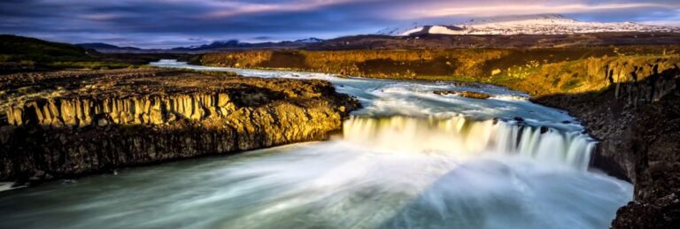
 One of the most beautiful drives when visiting Iceland’s South Coast is the valley through Þjórsársdalur. To reach it, take a left at crossroads 4 and drive 13km/8.1 miles until you reach crossroads 5, where you will make a right turn. You’ll soon be in the valley and driving is a joy. There is also a fantastic little campsite you can’t miss (and marked on the map). This area is steeped in history, and if road conditions allow, you can drive to Stöng (see map) and experience a real house from the Viking era. There you’ll find ruins dating back to the sagas, particularly those linked with Njáls saga. It’s a small hike to the house, but very much worth it. The caretakers have built exact replicas of the houses over the old grounds, but the foundation, some walls, and other artifact are still there. This might be the best time to experience a Viking long house. While in the area, visit the waterfall Gjáinn too.

Hrauneyjar
When you are done in this area, you can track back where you came from but we suggest continuing east on road nr:32 up to the edge of the highlands (avoid this route in winter). When you reach crossroads 6, take a left turn onto F26 (the road number is 26 in the other direction where you will drive going back to the Ring road) and continue 13km/8.1 miles to Hrauneyjar, the last outpost for the open, desolate highlands. There, you can fill your tummy and your camper before turning back. We don’t recommend going much further since the road isn’t as well-maintained from here. here really isn’t much to see up here, but the feeling of being there is truly magnificent. Driving this stretch allows you to say you’ve truly explored the highlands along the Southern Coast of Iceland. Just remember, as mentioned, this area is totally off limits during the wintertime.
 Going back, just keep driving 75km/46.1 miles on 26 (do not turn into the road you came from, keep driving straight) until you reach the Ring road again and take a left turn to continue your journey. This stretch has a long chapter of unpaved road, but is safe to drive on. Just take it easy and enjoy the ride along the roots of the Hekla volcano. You can also use the opportunity to stop by the beautiful waterfall Þjófafoss (Thief’s fall, see map). Like always, despite the road looking desolate and empty, don’t stop in the middle of the road to take pictures. Always park safely.
Hella & Hvolsvöllur
 Hella, Hvolsvöllur and further east are big, big agricultural lands, horses, and other significant places in the Icelandic sagas. Around both villages you’ll find horse rentals everywhere. Both villages, have stores, gas stations, banks, and whatever you might need. When you reach crossroad 8, take a left turn and drive road nr: 261, all the way to the end, well marked on the map (road conditions permitting). From there, you will have a great view of the volcano that no one outside Iceland can pronounce. The volcano Eyjafjallajökull! Here you will need to turn your camper and track back to Crossroad 9, take a left, and then have a nice and easy drive back to the Ring Road condition permitting. Take a left and continue your way through South Coast Iceland.
The waterfall road
 When you are back on the Ring road, you only drive for a minute before, Seljalandsfoss is on your left, the first of a few towering waterfalls on this stretch. Just to the left of Seljalandsfoss you have Gljúfráfoss (Gljúfrabúi).
A visit to the pool, Seljavallalaug is on this route too. Take a left at crossroad 10 and continue driving until you reach the parking lot. It’s only a 3km/1.8 miles drive. From there, you have to hike a little to reach the pool. Don’t forget your swimwear.
The next waterfall is Skógafoss, which you will see clearly on your left. If you visited the pool, it’s only roughly 6km/3.7 miles to the falls. You can camp by Skógafoss, and if you plan to spend some time there, use the opportunity to hike above the falls. A trail on the right side leads to the top and beyond.
When driving further you come to crossroad 11. If you turn left there you’ll come to the famous cliff with a hole in it, Dýrhólaey. A little bit further, at crossroad 12, you’ll find the black sand beaches of Reynisfjara. Both sites require a short hike from the parking lot. Please follow the warning signs.
Now you are very close to Vík which is just around the corner. Vík has an excellent camping site but we recommend driving a bit further and taking a left at crossroad 13. Then, drive 16km/9.9 miles to the campsite Þakgil, a fantastic campsite with excellent protection all winds.
Kirkjubæjarklaustur
 After exploring everything around Vík, you’ll drive east towards Kirkjubæjarklaustur. Back in the day, the open area between Vík and Kirkjubæjarklaustur used to be all black sand but after ambitious efforts to bind down the sand with for example Lupin, it isn’t all black anymore.
When you reach crossroad 14, turn left and drive for 3km/1.9 miles. You will arrive at the beautiful canyon Fjarðárgljúfur. Park safely and take a stroll along the banks, enjoying nature, drinking the water, and being be in awe.
Before you leave Kirkjubæjarklaustur, fill up your camper van with fuel and groceries.
 Just north of Kirkjubæjarklaustur, you have a very charming waterfall called Stjórnarfoss. When you drive there, you will have Kirkjugólf on your left side (Kirkjugólf = church floor), rocks that look like the floor of a church, basalt columns sliced down like tiles.
It’s only about 0.7km/0.43 miles between the waterfall Stjórnarfoss and Kirkjugólf and you have a parking lot between them.
Vatnajökull National Park
 When you continue east from the area around Kirkjubæjarklaustur, you’ll soon have an awe-inspiring site as you get closer to Vatnajökull glacier. One of the more fun features of driving this stretch of road is that you’ll be driving on a very long and beautiful bridge. The bridge is a single-lane, but there is nothing to worry about as there are plenty of places where traffic can let each other pass.
 It’s a 69km/42.9 miles joyful ride from Kirkjubæjarklaustur to the campsite in Skaftafell where we highly recommend you stay a night or two. You can hike up to a few gorgeous waterfalls from the campsite with views of Iceland’s highest peak, Hvannadalshnjúkur. There are plenty of glacier hikes to choose from and you can also take a glacier tour from here. You are also not far from Jökulsárlón! Just “around the corner”, you also have Svínafellsjökull, a glacier you park almost on top of. Well worth the visit.
Glacier lagoons
 Continuing further east you will pass not one but three glacier lagoons. The first one is Fjallsárlón and it’s a 47km/29.2 miles from the campsite at Skaftafell to Fjallsárlón. It is the lesser-known glacier lagoon but it’s definitely worth a visit. From there, you can hike (not the easiest hike) 3.2km/2 miles to Breiðárlón. A beautiful lagoon left alone by so many. We don’t know why the lagoon doesn’t appear on the map above, but we have marked the place. You can see it in this map. Anyone who commits to the hike will be greatly rewarded. Make sure you let others know where you are going.
 From Fjallsárlón to Jökulsárlón it’s only 11km/6.8 miles. By Jökulsárlón you can take a cruise on the lagoon, walk to the famous Diamond beach by the ocean and just take a load off and enjoy life. There is no camping by the lagoon so you will have to track back to Skaftafell or drive to Höfn, the end of South Coast Iceland but the beginning of East Iceland.
From Jökulsárlón to Höfn
 When driving further east from the lagoon, you’ll notice a significant drop-off of tourists as the lagoon is often the turning point for buses and many who have rented a car. After 14km/8.7 miles, you have a a fascinating museum to honor the author Þórbergur Þórðarson. The museum is a great place to reconnect with a bit of culture, but just seeing the museum itself is a treat as it looks like one big book shelf. (see picture to the right)
It’s a 79km/49.1 miles drive from Jökulsárlón to Höfn, the gateway to east Iceland and it’s a beautiful one. The landscape is big and beautiful. You’ll find small roads here and there but most lead to private farms and/or are just too rough to drive on in regular campers.
The whole drive from Reykjavik and the routes described above is 625km/388.6 miles. There are stretches where you really need to be aware of your speed and surroundings. The drive to Hrauneyjar is truly a road less traveled, especially by tourists, but it offers such a unique experience.
If you want to show your support for the conservation of Icelandic nature and to show you are a responsible tourist, take the Icelandic pledge.
Happy Camping! #WohoCamper


Iceland Travel Guides


If you like what you see, please subscribe to our YouTube channel!