Driving around the Westfjords is one of the highlights of Iceland. There you’ll find almost everything Iceland has to offer: quaint villages, high mountains, charming puffins, deep fjords, natural hot springs, a massive glacier, and beautiful waterfalls to name a few. Don’t want to miss out on these sights and more? Our Westfjords Iceland map and travel guide can help!
 If you were to drive the Westfjords in a counterclockwise direction, you would start by taking the Ring Road straight north, all the way to a gas station/rest stop called Staðarskáli. It’s a 2-hour drive from Reykjavík (164 km/102 miles) on a paved road to the gas station.
Take an immediate left when you leave the gas station. If you pass the bridge, you have driven too far; you will be driving on the west side of the fjord north of you.
From Staðarskáli to Hólmavík, it’s 110 km /68 miles and it will take you about an hour and a half to drive there if you don’t stop on the way. The route you will be driving on is called Strandir which means Beaches. If you stop by any beach there, you are bound to see plenty of driftwood coming in all the way from Siberia.
On the Westfjords Iceland map, below you’ll find routes, marked crossroads, and all the places mentioned in this travel guide. The small maps on the left will take you to the exact position on the interactive map.
 Crossroads
  Hot Springs
  Villages
  Point of interest
Hólmavík

 The village of Hólmavík and its surroundings have quite a bit to offer, including a great campsite in the middle of town and a swimming pool right next to it. The pool is not geothermal heated but it still has hot tubs.
Here you are within walking distance ofeverything, including the Museum of Icelandic Sorcery & Witchcraft, which is a must-see while in the vicinity. Have you ever heard of Necropants? Well, you’ll find the answer in the museum.
When you continue your trip and drive north for about 10 km/6 miles, you will arrive at a crossroad (see Westfjords Iceland map above). You can either just continue on the road you are on or take a right. If you do go right, you will see some stunning places on your way to the end of the road. Exploring this area will lead you back to the same crossroads, as you can’t drive around.
Steingrímsfjarðarheiði & Ísafjarðardjúp
 When you have driven for about 36 km/22 miles across the highland pass Steingrímsfjarðarheiði, a whole new world opens up to you. At this point, you’ll have reached the fjord Ísafjarðardjúpið, a huge fjord made of many smaller, but deep fjords. You will pass 9 different fjords before you reach the town of Ísafjörður, the capital of the Westfjords.
 Before you take on the drive, you might want to take a dip in the hot spring Nauteyrarlaug (marked in the map above). It’s a lovely little spring that’s not often busy. When you have reached the first fjord and drive north, you have a choice to make. If you take a right turn at the crossroads (on the map above), you’ll drive around that peninsula. We suggest you take road nr:633, but make sure you know the road conditions before setting off. Most likely, it’s closed during the winter.
In the next fjord, you’ll find an all-natural one hot spring.
Súðavík
 Now you have 4 fjords to drive through, with nothing but stunning nature with incredible views. Take your time, stop where you can and enjoy. It’s about 130 km/81 miles to the next village, which is Súðavík. Súðavík is now divided into two parts, the new and the old. After a disastrous avalanche in 1995 that killed 14 people, the village was relocated further into the fjord. Now the old part is only used in the summer months.
If you continue driving, on the other side of the peninsula you’ll find the largest town in the Westfjords, Ísafjörður.
Ísafjörður & Surroundings

 When you come to the 3rd crossroad (see map), you’ll continue straight to get to Ísafjörður and Bolungarvík.
Ísafjörður has too many interesting places to mention here; it’s a village full of life like most villages up here, which come to life after long winters with heavy snow and winds. When summer arrives, they all blossom.
If you enjoy museums and want to explore the region’s rich history, we recommend visiting the Westfjords Heritage Museum. If time is on your side, we highly recommend you take a boat trip to the northern tip of the Westfjords. A truly stunning destination with no roads and only the occasional house, like the one in Hesteyri. You can make a daytrip or be left somewhere and picked up at a predetermined time.
North of Ísafjörður, you have two more villages. Bolungarvík and Hnífsdalur, both very interesting to see. Just outside, you can hike the mountain Bolafjall. There is a road leading to an old radar station; the view from here is just absolutely gorgeous weather permitting.
Driving South from Ísafjörður

 When you continue south from Ísafjörður, you will drive into a very interesting tunnel. The 4th crossroad marked on the Westfjords Iceland map is inside this tunnel. You can take a right turn and the road will take you to Suðureyri, another small, picturesque village decently far from everything. If you continue straight through the tunnel, you will arrive in the next fjord. Before passing the bridge, you can take a right turn and visit Flateyri, a village quickly becoming the hip place to be, With ongoing renovations of old houses, it is a favorite escape for city folks.
Continuing South

 When you have crossed the next mountain pass and entered the next fjord, you will drive around it and come to the next crossroad. Here, you either turn left to continue your journey or drive straight ahead or about a minute to Þingeyri. In Þingeyri, you’ll find Simbahöllin, a charming coffee shop that serves as the hub of the village. It’s the perfect spot to learn about local activities, including tours and details about the nearby campsite.
Simbahöllin also has a strong focus on art and offers artist residencies. It’s well worth a visit and a great way to get to know the locals and local culture.
South Westfjords
 From Þingeyri, the next village, Bíldudalur, is a 95 km (59-mile) drive. To shorten the trip, you can take a left turn at the 7th crossroad (see map). Once you arrive, you’ll find The Icelandic Sea Monster Museum.
When driving this route, make sure you stop by the Dynjandi waterfall on your way south (see map). This breathtaking, wide cascade is a true gem of natural beauty and absolutely worth visiting.
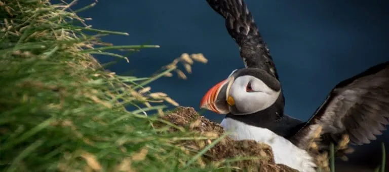
 Depending on time, we highly recommend you plan your trip so you can drive all the way out to Látrabjarg, Europe’s westernmost point (see map), so you can experience even more magnificent nature. There you’ll find dramatic cliffs, big waves below you, and puffins if the season is right.
Many travelers who have explored the Westfjords region consider Látrabjarg to be highlight of their journey.
The remaining villages on this side of the Westfjords, Bíldudalur, Tálknafjörður, and Patreksfjörður, all have campsites. Patreksfjörður is very close to Látrabjarg, making it a convenient base for an early start. However, it’s difficult to recommend one of these three villages over the others.
Bíldudalur
 If you decide to spend time in Bíldudalur, we highly recommend driving further north on the peninsula to Selárdalur to visit a very unique place where the renowned artist Samúel Jónsson lived. There you can walk around his art pieces and experience something out of the ordinary. It’s about a 21 km/13 miles drive to the museum. There is a small fee, and it is open only from June 10 to August 21 but it is quite a spectacular site to visit.
 If you’re camping in Patreksfjörður, the drive to Látrabjarg is 134 km (83 miles) and takes about 2.5 hours. About halfway there, you’ll pass the Hnjótur museum, which features various cultural items and Iceland’s second surviving DC-3 aircraft
After the museum, you will soon arrive in Breiðavík where your last camping site on this route is found. A lovely place just by the ocean.
South Westfjords
 After Látrabjarg you’ll have the south side of the Westfjords left with all its charm and beautiful places.
 One of the majestic places on the south side is the beach Rauðisandur. To go there, you’ll take a left turn at the 10th crossroad (see map) and drive to the beach. The road down to the beach is steep with 180-degrees turns, but it’s safe to drive; just, take care when driving down. There is also a very shallow river you have to wade across, but it’s very easy and pleasant. You can see the drive down in this video “Driving down to Rauðisandur”
The Ferry in the Westfjords
If you are tired of driving by now, you can take the car ferry to the Snæfellsnes peninsula. It will shorten your trip quite a bit, but you would miss out on driving the full circle around the Westfjords. If you want to take the ferry, you’ll need to pre-book it because you will be arriving in a camper.
Read more: Snæfellsnes Travel & Camping Guide
At the 9th crossroad, turn left onto road nr:62. This road will take you to Brjánslækur, where the ferry departs (see layer on map). Just north of the ferry, you’ll find Flókalundur, a little village perfect for taking a load off. Here, you can enjoy the local hospitality, its relaxed atmosphere, and have a swim in the outdoor pool. If you do not fancy a swimming pool, drive a bit further north to Hellulaug, a wonderful little hot spring with a fantastic view over the fjord.
 Before you leave Flókalundur, fill up your camper van with fuel, as you’ll have over 124 km/77 miles to the next gas station. You will yet again be driving in and out of a few fjords. These fjords are a little bit softer in shape compared to those in North Iceland, but are equally as breathtaking. You’ll only find two villages on this route. The first, Bjarkalundur, is where you’ll find your next gas station. South of Bjarkalundur is Reykhólar, a small village with a campsite, a gas station, and a grocery store.
Driving to Reykjavík

 If you decide to start to drive back to Reykjavík, it’s easiest to keep on driving south from Bjarkarlundur, all the way to the Ring road, where you take a right turn and just keep going. Before you reach the Ring road, you will arrive in the village of Búðardalur.
This whole trip, starting from the gas station in Staðarskáli and looping back to the Ring Road (see map), covers a total of 877 km (545 miles). Driving nonstop would take over 13 hours, not including detours to peninsulas or fjords. Overall, this route, beginning and ending in Reykjavík, is only slightly shorter than the Ring Road itself.
General Information
The Westfjords are an incredible place to visit, and with far fewer tourists than the Ring Road. If you look at the map of the Westfjords, Iceland, above, you will see a few points of interest, but there are many places to see. If you zoom into the map, you’ll see other places that we didn’t mark. It’s only a question of what you want to do. It is much shorter in between places, and the roads are not all paved. You can get a good sense onfhow it is to drive around there in this superb French video here!
Any village up there will have a campsite, and you’ll also find them outside of villages near farms and other locations. You’ll never have to drive far to find one. Swimming pools are also available in nearly every village.
Westfjords in Winter
Since there are numerous unpaved roads leading you to some absolutely stunning places, we would recommend you rent a 4×4 camper for the journey.
If you want to drive this trip during winter, you’ll need to stay on top of the weather forecast and road conditions. This area is known for rapid weather changes and heavy snowfall so plan your trip accordingly. It’s quite an adventure!
For more information on activities, places to visit, and planning your dream trip to the Westfjords, visit the official Visit Westfjords website.
If you have any questions, feel free to contact us at rent@rent.is.
Safe travels!


Iceland Travel Guides


If you like what you see, please subscribe to our YouTube channel!