To the Golden Circle & Southeast Iceland
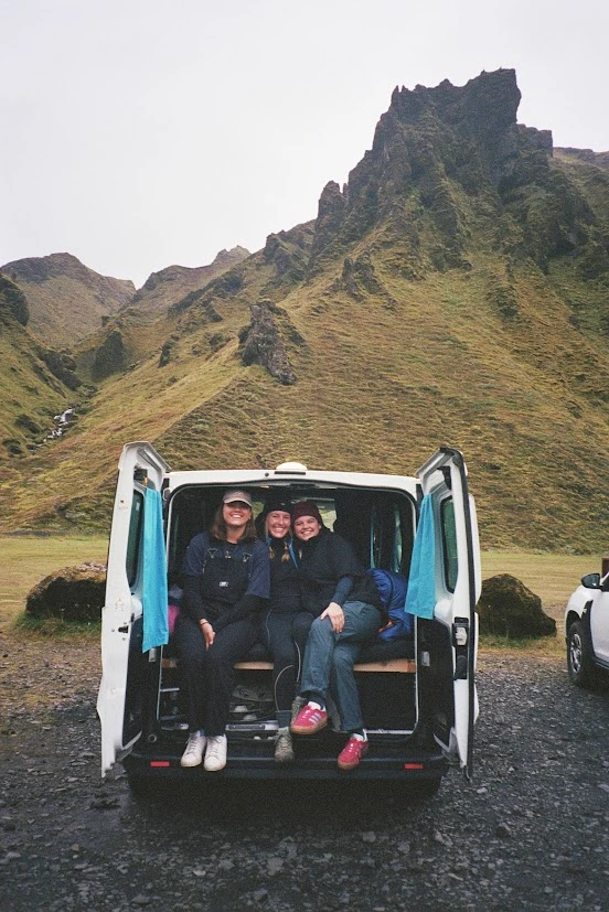
Our Icelandic adventure took place over 12 days and 11 nights of magical moments, during the Christmas holidays. For the first part of our trip, we stayed in an Airbnb accommodation in Seltjarnarnes (west township of Reykjavík) for 5 nights. Then we rented a camper van for the 2nd part of the holidays, which allowed us to explore Iceland for 6 astonishing days. On the last day we returned to Reykjavik to celebrate New Year’s Eve and experience the breathtaking firework display over the capital.
Despite the cold weather, lack of daylight and testy road conditions coming to Iceland during the Christmas holidays is a life changing moment. Lavish Landscapes, sublime sunsets, alleviating hot springs, Northern lights, gigantic glaciers and so on…
Day 1 / The adventure begins!
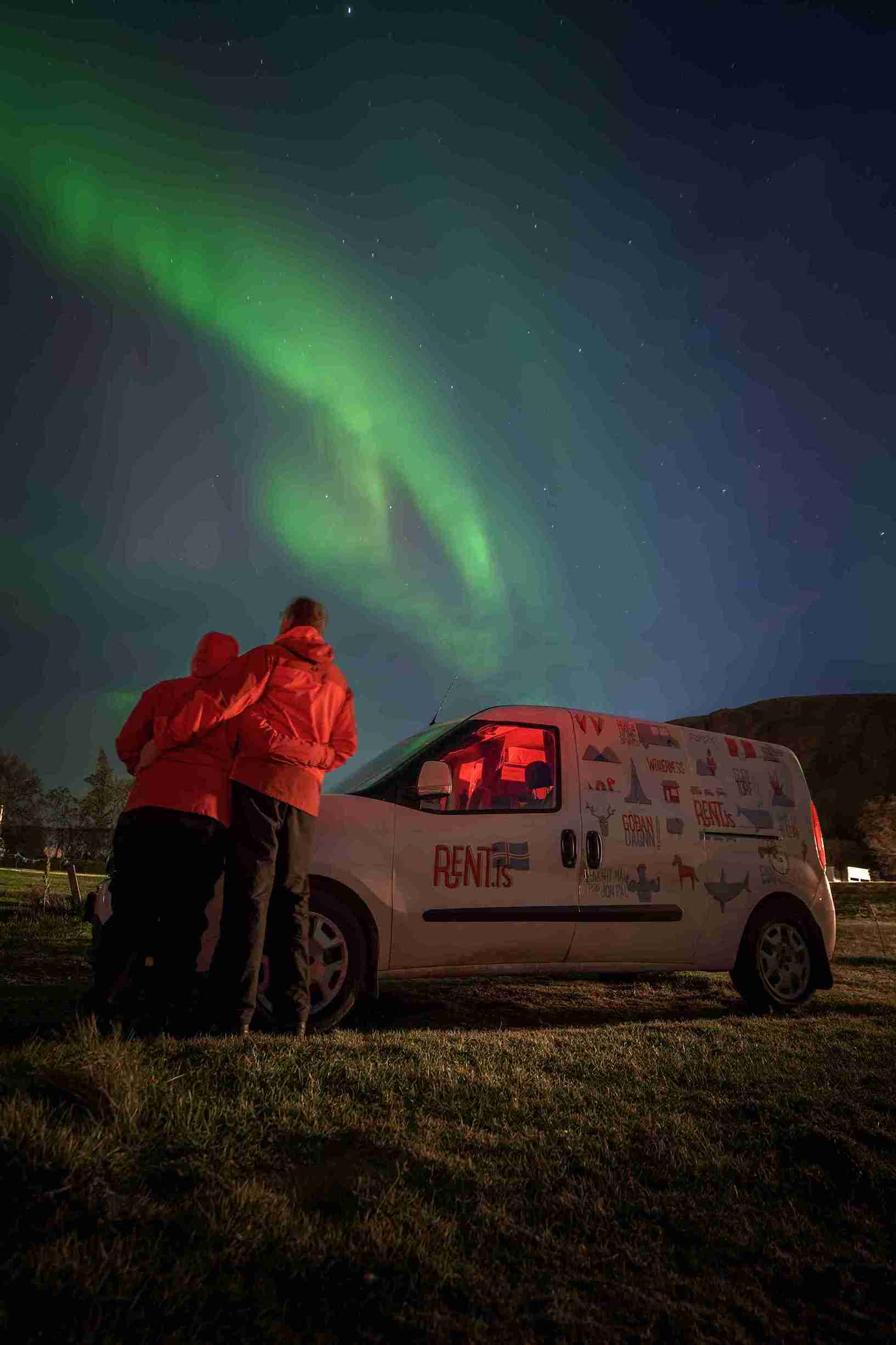
We picked up our campervan at Reykjavík office around 12pm.
We drove directly to Thingvellir (Þingvellir) National Park to witness the Mid-Atlantic Ridge literally tearing Iceland in half. The fissure created by the tectonic plates separates the east and west by a staggering 2cm every year.
The rustic weather conditions created an atmosphere rather unique. Cliffs cloaked with spots of white snow and black volcanic rock, overlooking the largest lake in Iceland: Thingvallavatn (Þingvallavatn). A slight breeze carried snow through the valley of the park, all the way to a dormant and calm Thingvallavatn.
At the belvedere, the view stretches to the horizons and one can almost imagine the Norse settlers migrating across the North Atlantic over a 1000 years ago. It’s no surprise that Iceland’s historic parliament was founded right here in Thingvellir.


The return journey to Reykjavík was mostly in the dark and the road was covered with fresh snow. When we arrived to the capital it had already snowed for a few hours. Roads, gardens and roofs were draped in white and it made the perfect picture for Christmas eve.
We stayed one more night in our Airbnb accomodation in Seltjarnarnes and braced ourselves for the unknown.
Day 2 / Golden Circle
The next day, we left early to explore the wonders of the Golden Circle.
First stop: Gullfoss, for a morning sightseeing of the dramatic waterfall. The gust was strong and the temperature was reading a frosty -8º Celsius. A thick inch of ice saturated the walkway but the rising of the sun on top of the highland plateau was announcing a sunny day. Crampons were not essential here but can make life easier.


Buoyed by the crushing sounds of Gullfoss, we were excited for our next stop: Secret Lagoon in Flúðir. Upon arrival to Flúðir, the sun was at its peak, coating the surrounding hills in a golden expanse.
Secret Lagoon is really charming. The pool is surrounded with mini geysers, from where the ejecting water flows directly into the pool. Although the water at the geyser is so hot that it turns the surrounding mud into acid, the water cools to a pleasant 40º Celsius open arrival at the pool. This hot spring is less well known compared to the Blue Lagoon on the Reykjanes peninsula and therefore it’s not as packed and more family oriented.
The changing rooms and showers are large, well equipped and maintained. Friðheimar restaurant is close by serving organic-greenhouse produce. On Christmas day however, only the restaurant of the Secret Lagoon was open which offered sandwiches, soup, coffee/tea and desserts.
After lunch we drove back to Geysir to watch the sunset steal the giant ejection of hot steam made every 7-9 minutes by “Strokkur”. Geysir is no longer active at the moment, but Strokkur is very
reliable. The surrounding field is filled with mudpots and other geothermal activity. An imposing arena, the contrast between hot and cold is undeniable here.
At the end of the day, we drove down to Selfoss where we stayed overnight at the Gesthús campsite. After a nice diner at Kaffi Krùs restaurant, we got ready for our 1st night in the camper van.


Day 3 / South Iceland
Our 1st night in the camper van was good and the heater kept us warm all night. In the morning, we used the campsite kitchen and dining room to prepare a good breakfast prior to hitting the Ring road toward south Iceland.
Since daylight is the shortest at this time of the year in Iceland, we chose to do indoor activities in the mornings which saved time for sightseeing and hiking during hours of daylight.
The brand new Lava Center is an interactive, high-tech educational exhibition depicting volcanic activity, earthquakes and the creation of Iceland over millions of years. Located in Hvolsvöllur South Iceland, the site is surrounded by many active volcanos, which makes you feel right in the middle of the action.
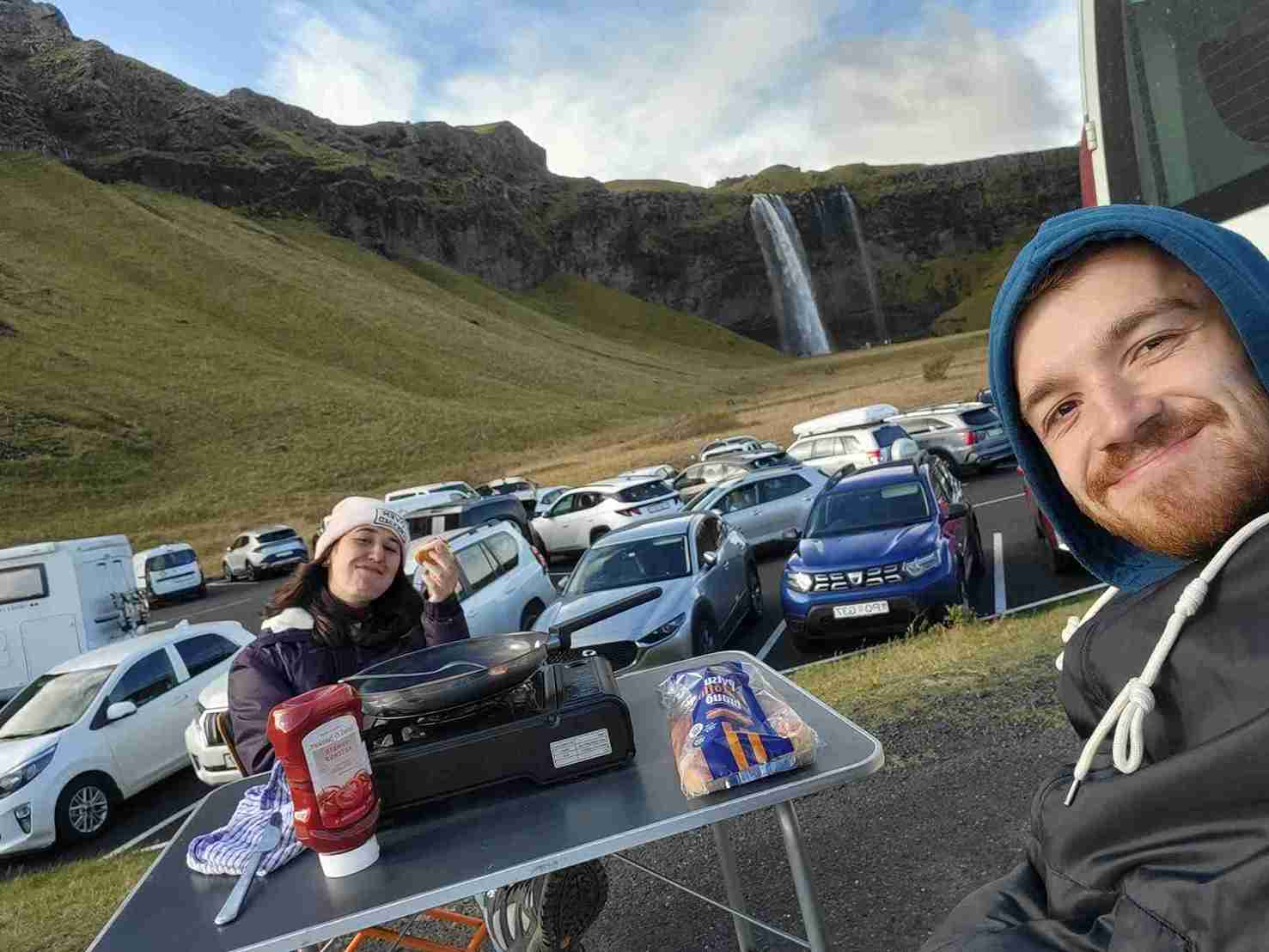
When our visit was completed, the sun was already out and we drove to the next destination : Seljalandsfoss. This waterfall is one of the most sought after in the country, from its 65 meters high, it
stands among the highest of waterfalls in Iceland. But what makes it particular is the possibility to walk behind it. Unfortunately during winter, the icy and narrow path to access the rear is impossible to cross. Nonetheless the site offers a great view of Helka volcano and the archipelago of volcanic Islands Heimaey and Surtsey among many smaller ones. The 1973 eruption from Mont Eldfell that destroyed half of Heimaey is explained in the Lava Center.


Our next stop: Dýrhólaey cliff and black lava sand beach.
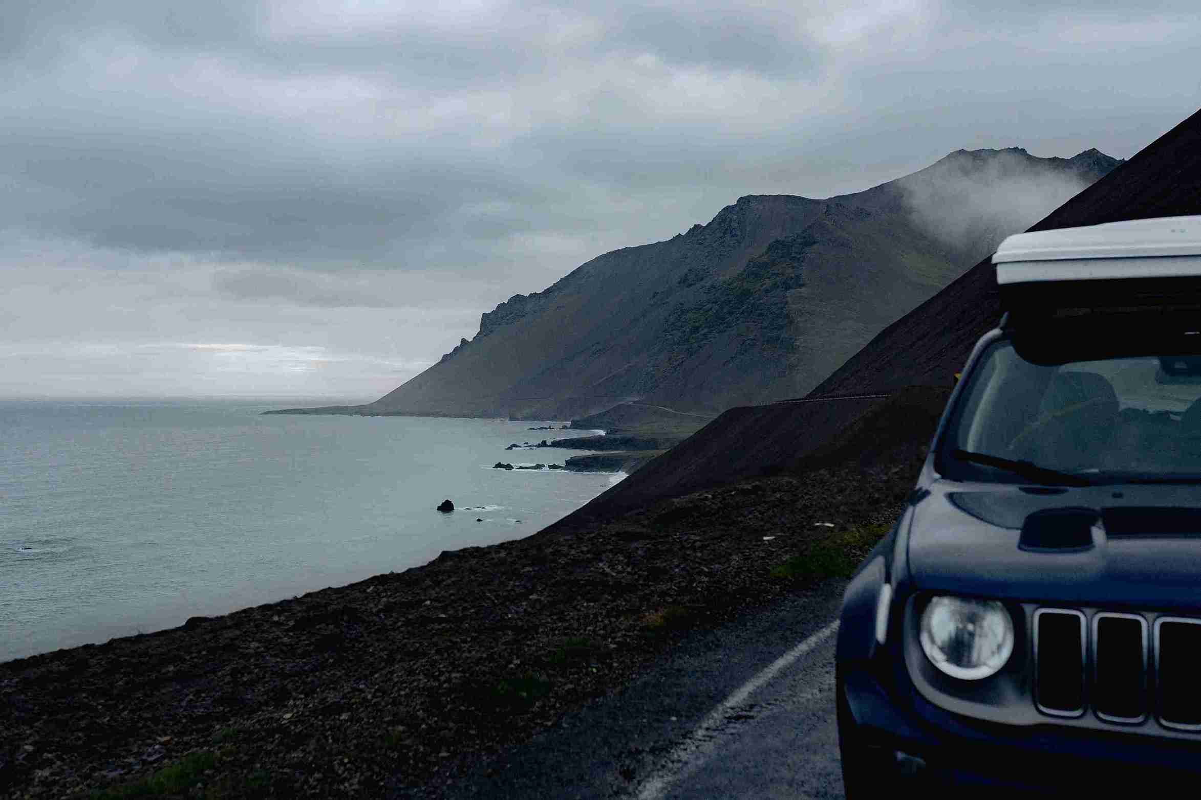
To reach this place, we took the ring road around Mýrdalsjökull glacier along the south coast. This dry and blasted geography is crippled with next to no vegetation and scarred by giant black volcanic rocks from previous eruptions. Driving through this shadowy silent world makes the experience unforgettable and bestows a feeling of freedom. On sunny days, the warm flickering light of the sun reveals the rocky mountains with their white cap of snow, contrasting with a bright blue sky. The view is simply astonishing.


When we arrived on top of Dýrhólaey cliff the wind was blowing strongly. The glacier is very close, serving as a highway for the glacial wind, delivered swiftly from the north pole. Here again, the marvels of the landscape offers a great contrast of colors between the black lava sand, the yellow faint grass on the mountains and the white glaciers at their heels.


Before it got dark, we drove to the town of Vík. We found a supermarket to buy groceries, a restaurant and a swimming pool equipped with a small hot spring and a sauna. The perfect place to go after a full day out in the glacial winds of south Iceland.
We found a spot for our camper safe from the elements, for the night at Vík campsite. The facilities were open but the office was closed. Too exhausted to wait for the Northern lights, we went to sleep with our minds bursting with the great landscapes of South Iceland and the uncharted of tomorrow.

Day 4 / Southeast Iceland
We left Vík early and drove for 140km in the dark to reach Skaftafell National Park right at the foot of the biggest glacier of Europe : Vatnajökull.
When we arrived to Skaftafell the sun was just coming out. We had a hot coffee at the visitor center and headed for a 45 minutes hike to Svartifoss waterfall and Sjónarsker view point. Most of the hiking path was covered with a thick layer of ice, which wouldn’t be possible to access without crampons. Luckily, the sun was shining and we could feel a little warmth on our cheeks as we hiked to the waterfall. From Sjónarsker, we could see the vast lowland lying toward the ocean dominated by the peaks of Vatnajökull. The mist curled and smoked above the marshes in a dream like wisp.


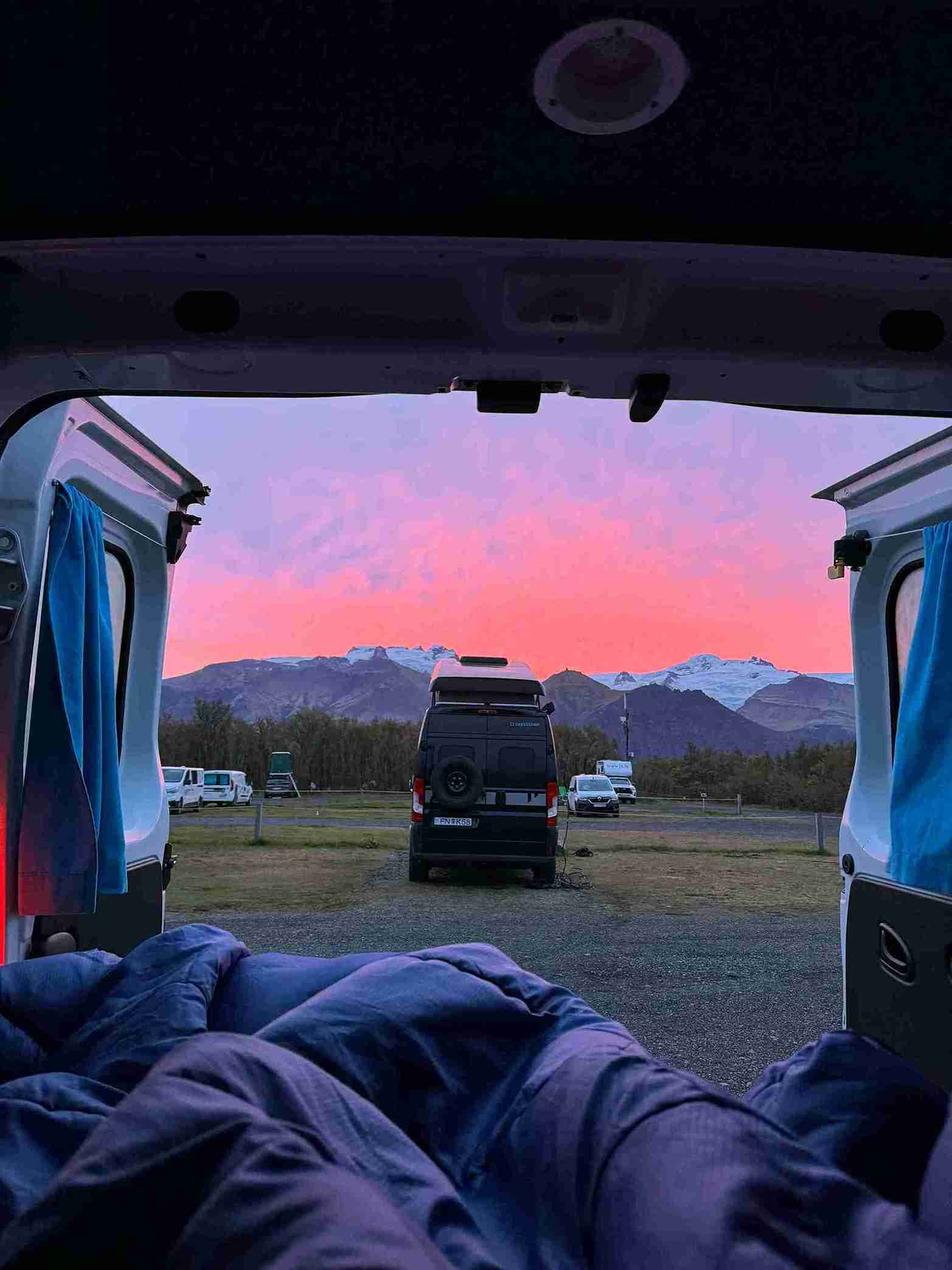
Just before noon, we hit the road again to our next and most expected anticipated destination: Jökulsárlón lagoon. The lagoon lies at the foot of Breiðamerkurjökull glacier, one of the 30 outlet
glaciers of Vatnajöjkull. Due to global warming the melting of the glacier is so quick that a lagoon has formed right at the bottom of the glacier. The water and gigantic icebergs follow its course to reach the North Atlantic at the mouth of the lagoon. The black sand beach, also known as “Diamond Beach” ensnares diamond blocks of ice before the waves of high tide brings an impetuous end to their narrative. It’s a bittersweet setting, for although magnificent to observe, the ice tells a story about climate change and the virtually irreversible devastation the human race has upon our home, our planet Earth.


We sat there, acknowledging what was in front of us, until the sun faded away from the horizon. Then headed for a nice hot bath at Höfn public Swimming pool. This town is the farthest place we went toward the East coast. It’s the biggest port of East Iceland and very famous for its Lobsters.
The camp site was closed but we could access the comfortable, well equipped and maintained facilities.
Day 5 / Breiðamerkurjökull glacier walk & ice cave tour
The big day of our trip has come!
We have booked a full day glacier walk and ice cave guided tour with one of the many guide companies in Iceland. After a good breakfast at Höfn camp site we headed to the meeting point with our guide in a state of excitement and impatience. The forecast for the day was clear sky and -3º Celsius. We were just hoping the wind would calm down because it has been pretty strong in the area for the last couple of days.
The guide took the group at the mouth of the glacier with a huge buggy style jeep. Prior to start the hike, we were given harnesses, an axe, 2 types of crampons (mini and maxi crampons), a frontal
lamp and a helmet. After receiving the necessary recommendations for security we hiked toward the glacier.
When we reached the ice we replaced the mini crampons with the maxi ones and we commenced our walk on the “frozen sea”. Our steps created cracks through the surface and sent shivers down our spine. This happens when the outside temperature is very cold. It was -3 but it felt like -5. Thankfully the wind was not too strong which made the hike enjoyable.
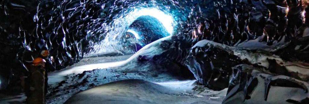
After a 45 minute walk we reached the ice caves. From the entry point of the caves, one receives a complementary view of Jökulsárlón Lagoon. Inside the cave it feels like another world. The quietness and massive ice walls give the place a static atmosphere. The few rays of light captured in the ice above our heads offer various shades of icy light to dark blue. Everything seems peaceful yet the shape of the ice walls tells us that this blue paradise is melting and is not meant to last.
Our day ended with a hot spring bath in the swimming pool of Kirkjubærjarklaustur. On our way back to the camp site, we saw a glimpse of Aurora Borealis on a too bright moon sky.


Day 6 / From Southeast to Southwest Iceland
The next day, was essentially driving back to the southwest of Iceland and the city of Reykjavík. Although, we did several short stops to places we couldn’t see on our way to southeast Iceland :
Fjaðrárgljúfur canyon, which was created by progressive erosion by flowing water from glaciers through the rocks and volcanic glass during the cold periods of the Ice Age, about 2 million years ago. Skógafoss waterfall, situated on the Skógá River at the cliffs of the former coastline, which has receded seaward for a distance of about 5 kilometers. The waterfall is one of the biggest of Iceland with a drop of 60 meters.

By the afternoon we reached Krýsuvík Geothermal park on the Reykjanes peninsula southwest coast. The area is in the middle of the fissure zone on the Mid-Atlantic Ridge which traverses Iceland. Krýsuvík consists of several geothermal fields, such as Seltún. We stopped there for a little walk through the field which has developed a tourism infrastructure and wooden pathways. There mud pots and hot springs have formed surrounded by ghostly figures of vapor. The soil is colored bright yellow, and shades of acidic red. Krýsuvík is also a popular hiking area.

Our long driving distance day ended in the port town of Hafnarfjörður 10 km south of Reykjavik.

Day 7 / Gethoermal tour Hengill Volcano
On the final morning, we went to the geothermal exhibition center “OnPower” to the Hellisheiði Power Plant. This geothermal area is right on the Hengill volcanic mountain, only 20 minutes drive from southeast Reykjavík. ON Power is a leading power company that produces electricity and geothermal water for heating, mainly by harnessing geothermal energy. Renewable power sources account for more than 70% of the total primary energy consumption in Iceland, far higher than anywhere else in the world. The exhibition is presented via interactive multimedia installations, wall displays and presentations. Guests of all ages can enjoy and examine Iceland’s geothermal utilization in a clear and illuminating fashion.

 Around noon, we drove back to Rent.is office to drop off the van and went for a long walk in the charming city of Reykjavík.
Ildar & Marlene
Read more: Celebrating New Year’s eve in Iceland
Happy Camping! #CamperStories
Iceland Travel Guides


If you like what you see, please subscribe to our YouTube channel!