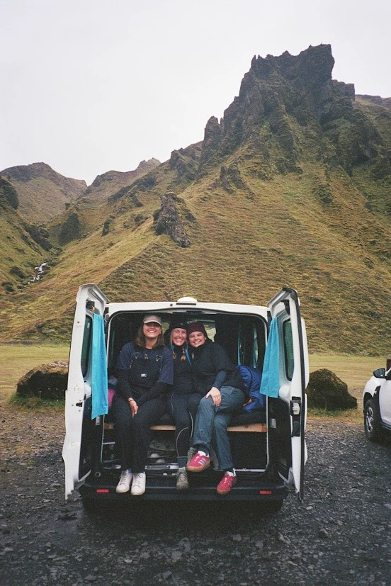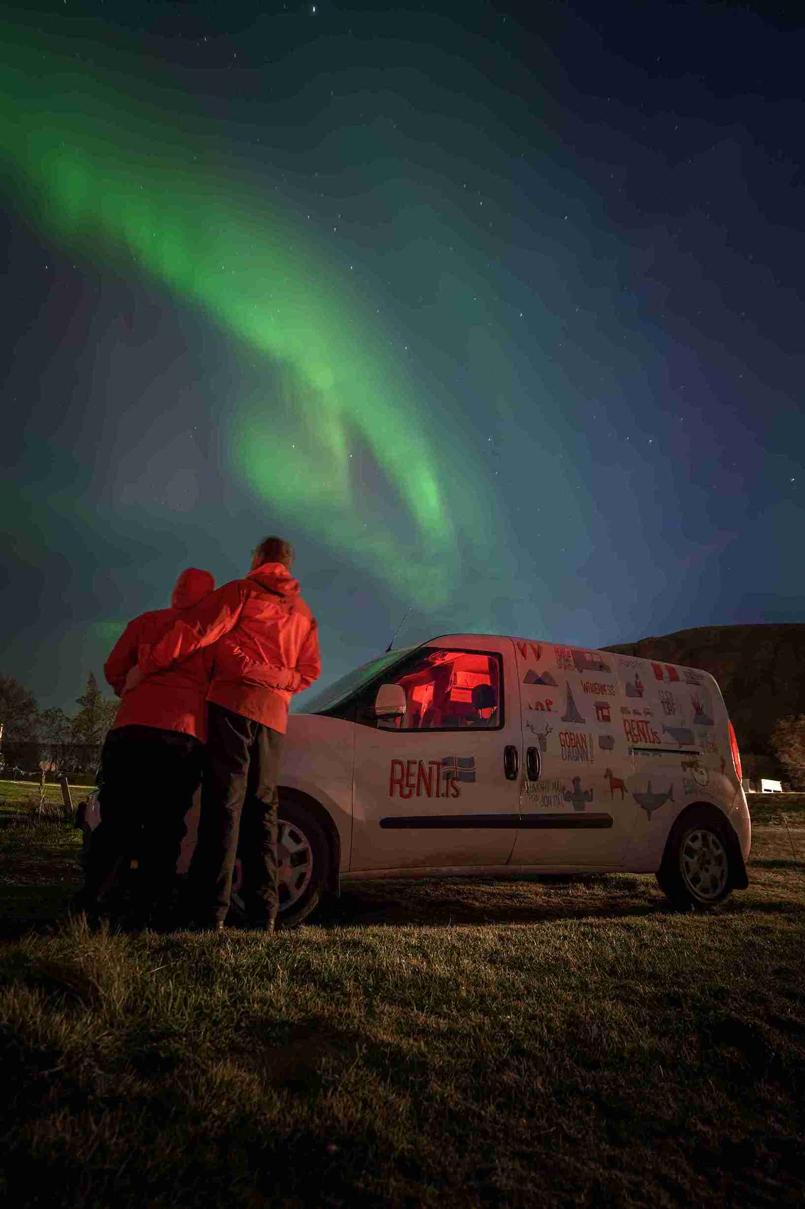
We picked up our camping-retrofitted Renault van on the east side of Reykjavik at 9:00 on a Monday morning, the first of July. It was my second trip to Iceland in two years, but my husband’s first. We had reserved a 5-person van in case one of our adult children decided to join us. They foolishly declined, but we were happy for the extra sleeping space.
 After a wrong turn and a quick check with the owner’s manual for instructions on how to put the van in reverse, we were zipping north on Highway One, the Ring Road, so-called either because it travels in a giant ring around something or because it’s laced with adorable Euro-style traffic circles instead of American-style on- and off-ramps. Americans considering driving in Iceland will be happy to know that they drive on the right side, like normal people. Just remember that the speed limit of 90 refers to kilometers, not miles. We stopped for groceries at the Bónus store in Mosfellsbær, but after waiting ten minutes for the ridiculously late 10 AM opening time, discovered it did not open until 11.
Undaunted, because we had enough food for lunch and knew there were towns ahead, we jumped back in the van. The sky was dark and spitting rain; reportedly the sun had not been seen in Reykjavik for the entire month of June, a 100-year record, while the rest of Europe suffered through a heat wave. We didn’t regret missing the plus-100 temperatures in our own home state, but were happy we’d decided not to tent-camp.
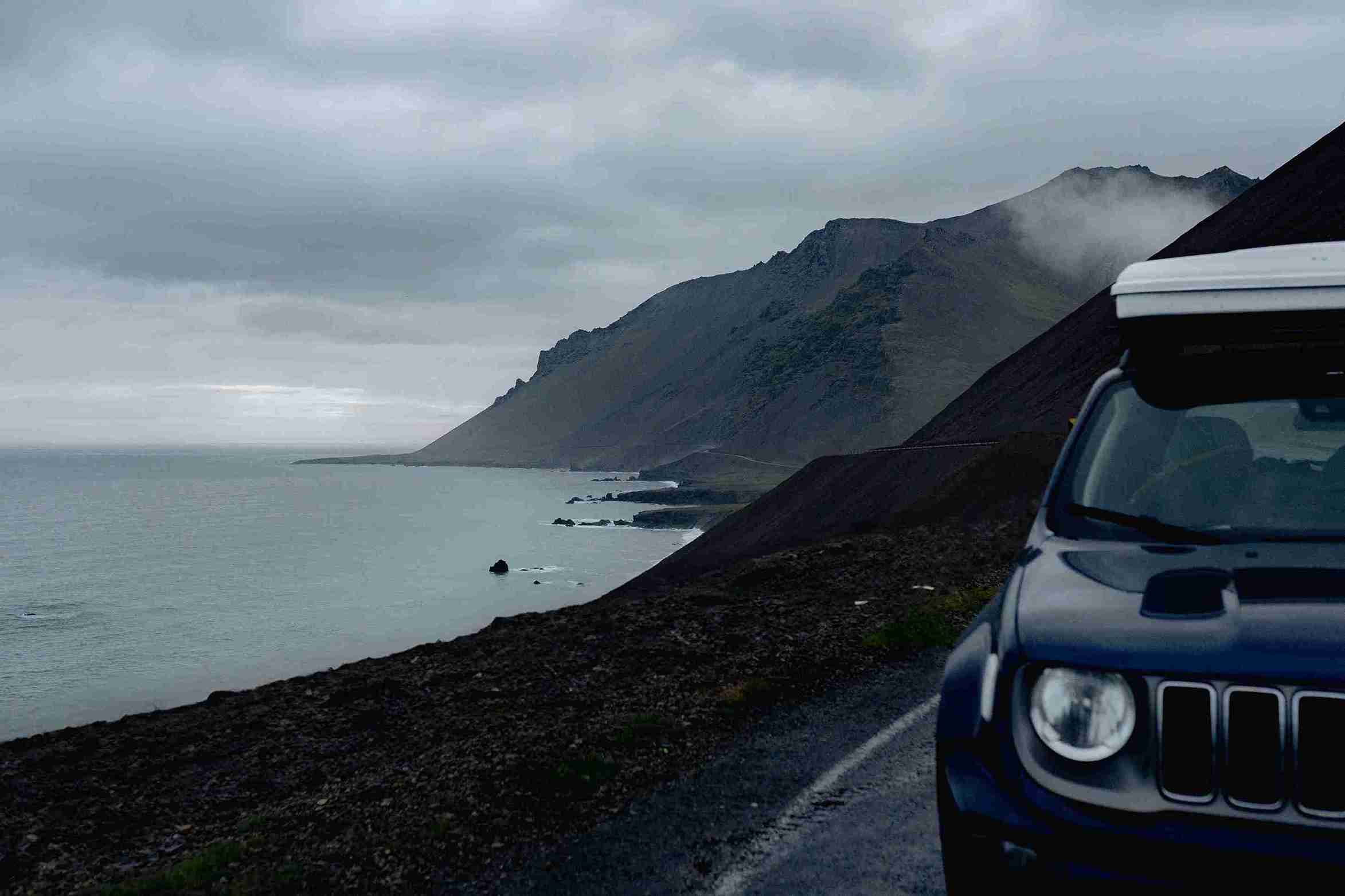
The road narrowed to two lanes as we emerged from the color-coordinated suburbs onto lupine-carpeted open land, with the Atlantic ocean on the left and steep green-sided mountains on the right disappearing into the low dark clouds. At the apex of the first fjord, we stopped at a bridge and got out in the rain and bluster just to watch a wide river tumbling under it. A short time later, at the top of the next fjord, Foraging-Hvalfjörður, we turned right onto a narrow dirt road at a tiny sign reading “Glýmur.”
Our Rough Guide to Iceland noted that Glýmur is the tallest waterfall in Iceland but maintained that it is almost impossible to view, recommending we “allow an hour” to try (editor’s note: Glýmur has been bumped down to the second tallest). It was raining again, so we fixed sandwiches and tea in the van’s tiny kitchen and ate them on the spot in the gravel parking lot at the trail-head. The rain stopping on cue and the sky brightening in a promising fashion, we embarked on what turned out to be one of the best hikes we’ve ever taken. A map and sign in Icelandic and English described some natural history and advised “log is on river,” which we noted but did not understand. The trail ran wide and easy up a sloping foothlll, above which we could see a number of intriguing black channels into the mountainside. After a mile the trail descended through a short tunnel of lava to the edge of a raging torrent. A roaring noise and a cloud of mist from upriver indicated that the Glýmur was near, but it was hidden behind the bends in the canyon. Here we encountered the “log on river.” In lieu of a bridge, a steel cable was strung across the river alongside a series of partially submerged stepping stones and about 20 feet of wet, smooth tree trunk. We had not brought our river-crossing shoes, so we stripped down to bare feet and tied our boots to our packs. Given the volume of water and the strength of the current, this looked a bit daunting, but keeping one hand on the cable made it very easy. I will note here that on the return hike we encountered a man carrying his barefooted girlfriend over his shoulders to get back to their car, she having lost both boots to the river. We, however, were not born yesterday and did not make the mistake of holding our boots in our hands during the crossing.
After the invigorating iced footbath, the trail climbed very steeply up the right river bank for another mile. At some, though not all of the steepest and slipperiest points, a cable or marine rope was strung between metal posts. The roar of the falls grew louder, the mist thickened, and numerous gulls and auks wheeled above us, but Glýmur remained out of sight until we reached a high cliff edge. Then it revealed itself all at once, a narrow spear of crystal dropping xxx meters through a spectacular black and green gorge dotted with nesting and wheeling seabirds and crowned with mist, the stuff of your wildest Icelandic dreams. Words and pictures cannot capture it; you are going to have to see it for yourself.
 After eating biscuits (the British word for cookies dipped in chocolate) and getting chilled by the steady mistfall, we continued up the trail to a sign suggesting it might be possible to “ford the river above the falls” and make a loop out of the hike. The trail topped out half a mile later (punctuated by more viewpoints with different angles of the upper part of the falls) on a green plateau. In contrast to the 2 meter-wide chasm at the foot of the falls, the river above the falls was at least 50 meters across, running bumpily across a rocky bottom appearing to be less than a foot deep. After watching some hikers on the opposite bank shake their heads and turn back, we spent some time considering whether it was possible or safe to cross it in bare feet without hiking poles, but the spirit of the waterfall had caught us. It turned out to be possible, though painful and probably not at all safe. Luckily the water quickly numbed our lower legs so the pain of the sharp rocks was somewhat dulled. We made it across without falling in, losing our boots or bloodying our feet, but agreed that we would always carry our river-crossing shoes in the future. A pair of hikers still on the right bank hailed us and made a gesture indicating, “Do you recommend it?” Rob promptly gave a thumbs up, so we had to stay and make sure they made it, lest we live forever with the guilt.
Whether we took a wrong turn or whether bushwhacking is the norm on hikes in Iceland, the trail back down the mountainside on the north side of the river was extremely steep and rough, involving a couple of slides down muddy ravines and jumps from rocky ledges. We were glad we did the loop in the counterclockwise direction and wondered if the Rough Guide author had tried to go clockwise. Back on the well-marked main trail, we encountered the bootless hiker and made it back to the van just as the rain started. It was 4 PM (16:00, in Icelandic) and we were less than halfway to Snæfellsnes, but we could not have lucked into a better introduction to the west of Iceland.
Test your knowledge: Iceland Quiz
 Our next stop was the Netto grocery store in Borgarnes, where we stocked up on groceries, as well as a kilo of fabulously inexpensive Icelandic Einband and Lettilopi wool to support my knitting habit for the next year or so. Yarn is one of a small number of things in Iceland that is not extremely expensive, plus you can buy it at the grocery store or the hardware store. Food is costly, but less so in grocery stores than in restaurants, and some delicious locally-made foods like Skýr, dark bread, flat bread, chocolate and fresh carrots are a pretty good bargain. It is startling at the cash register to be asked for “One hundred thousand and four krona,” until you move the decimal points in your mind and realize that this is something less than 100 U.S. dollars.
North of Borgarnes, the van climbed onto a lava-crusted plateau and we glimpsed the bases of the mountains that run down the spine of the Snæfellsnes Peninsula. In less than an hour we had passed through this range and were descending the north slope of the peninsula into the beautiful seaside town of Stykkishólmur. This turned out to be our favorite town of the whole trip and is pronounced exactly how it looks, but my husband referred to it as “Stishkish” or some other random assortment of consonants for the duration. It was evening, but as it never gets dark in Iceland in the summer, and as the sky was still covered in clouds, the day still seemed young. The town campground was in a verdant, slightly muddy field on the outskirts, and we paid the camping fee to a Los Angelean who plays on the local semi-pro women’s basketball team. It was a short and pleasant walk downtown to an excellent restaurant for dinner. Afterwards we walked across the harbor and climbed a steep hill to see the town’s old lighthouse and a fantastic 360-degree view of the Snæfellsnes range, finally emerging from their cloud cover, the North Atlantic, dozens of tiny green islands, and far to the north, the West Fjords. Someone later told us that one of the islands belongs to Bjork. Passing the town swimming pool and playground on the way back to camp, we encountered two look-alike little girls in matching Icelandic Lopi sweaters doing back somersaults and flying aerials on massive rectangle of inflated rubber attached to the ground by its edges, an awesome piece of playground equipment never seen in the United States. It was ten PM (22:00). Rob took a video.
The campground was full by now but still very quiet. No one was running a loud generator, blasting heavy metal music, setting off fireworks, or burning a smoky fire, as they might do while camping in another country I could name. The vans’ curtains blocked out most of the midnight light, and we were warm and comfortable without running the heater, even though a cold wind blew all night. In the morning I ventured to take a shower in the open-air campground showers. The bottomless, topless walls let plenty of wind in, but the water was hot and sulphury. Even though we had both charged our phones on the van’s battery all night, it was still fully charged to run the heat for an hour.
By 9:00 AM we were on the road headed west. After stopping for a pastry and a trail map in Grundarfjörður., we parked by the roadside and made the short hike to Kirkjufellsfoss to take the iconic photograph of the falls in front of the famous church-shaped mountain called Kirkjufell.
 An hour later, we pulled into the campground at Hellissandur, an emerald green pocket a reef of lava. After checking in, we drove into the very understated Snæfellsjökull National Park, looking for a good hike. We set out four times at various trailheads, sometimes in the rain, only to have the trail disappear into the gnarled and impassable lava fields. On the fifth try, coincidentally marked trail 5 on our park map, we finally struck it lucky. Trail 5 heads north from the rough dirt road that leads to Svörtuloft lighthouse. Blue and white posts pounded into the lava mark the way. We explored some lava caves, climbed into an extinct crater, then looped back to the road on trail 6, an ancient viking road marked with tall stone cairns. We didn’t see a soul, and I regretted not bringing any small children to appreciate the elf-worthy landscape. The sun peeked out for the first time on our trip, and the glacier-capped summit of Snæfellsjökull emerged from the clouds. At the trailhead we headed left toward the sea instead of right towards our van, capping the hike with a stunning view of a sea tunnel and the old orange lighthouse above it.
 Back at the campground, Rob spotted a flier advertising a new fine-dining restaurant just half a kilometer up the road. Viðvík was situated on the edge of town in a snug new black-sided building. We had a sumptuous “new Scandinavian” dinner, of which carrot purrée was a highlight, and a stunning view of the glacier, met the young chef, then headed towards town for our evening stroll.
A sign in Hellissandur, population about 800, read “Welcome to Hellissandur, wall art capital of Iceland.” Sure enough, we soon came upon a vacant fish cannery whose walls have become a canvas for talented muralists. Across the highway we discovered the most beautiful soccer pitch in the world, a rectangular green carpet of plush turf surrounded on all four sides by a two-meter high reef of black lava.
 Night two was even quieter than the first night. We set out in the morning directly from the campground, looking for a loop hike described in the Rough Guide, but the trail dead-ended at a farm after a mile. We got in the van and drove several miles into the park, took a left on a gravel road headed toward the glacier, and had a beautiful, misty walk up this road to circle the Rauðhóll crater and visit two small but beautiful waterfalls.
Back at the van, we drove around the western point of the peninsula to the south side, stopping briefly at the town of Arnarstapi for a sausage sandwich for Rob. As chilly as it had been on the north side of the peninsula, it was much colder on the south side, even though the sun was out, with an icy wind blasting up from the ocean. We could not find the town campground and felt nostalgic for Stykkishólmur.
 We headed east , stopping briefly at Rauðfellsgjá Gorge. This is a narrow crack in the mountainside that you can hike into. In our part of the world it’s made of red sandstone and we call it a slot canyon, but this one was eroded from the black basalt and packed with melting snow except for a gap at the bottom about five and a half feet high. In the middle of the afternoon with two tour buses visiting, it was the only crowded location we encountered on the peninsula. Rob stayed in the van to eat his sandwich, but I ventured up the steep slope with a long line with teenagers and Asian tourists to boulder-hop into the mouth of the canyon. After a couple of zig zags I became claustrophobic and had to get out, not because of the close black walls on either side and the overhanging snowbank hitting me wetly on the head and shoulders, but because of the endless stream of people. This one is better visited early in the morning or after dinner, I think.
 We continued east and then turned north on the Snæfellsnesvegur. We made a stop at the town laundromat in Grundarfjörður, which consists of one washer and one drier in a tiny hut in someone’s front yard. I wanted more hiking, so Rob dropped me off 4 kilometers south of town to walk out to Helgafellssveit, a high mound with an ancient chapel ruin on top. It’s privately owned by a family that charges admission, but luckily I had the 400 krona in my pocket. The chapel ruin was two feet high and smaller than my bathroom at home, but the view of the islands and the Hvammsfjörður was worth the climb and the price. The hike back along the main road was a bit longer than expected, but there were sheep and friendly Icelandic horses along the way. Rob, acting like a local, had gone for a shower and swim at the town pool. We hiked into town for dinner and found every restaurant full, but eventually got a table at Narfeyrarstofa, the same place we had eaten two nights before.
 Thursday was our last morning in Snæfellsnes. Rob was worried about getting the van back on time, but I couldn’t bear not to hike one more time. We drove south over the Vatnaleið pass, glimpsing a big waterfall near a farm on the left as we descended the south side of the mountains. I talked Rob into driving up the farm road and parking near the gorge below the waterfall. After about a mile of bushwacking over stones and squashy turf, we made it to the falls, a beautiful long cascade partially blocked from view by a protruding fin of lava. There was no trail or signage, only some grazing sheep. Near the falls, we stopped in the town of Vegamót, consisting of one church, three or four farmhouses, and a tourism bureau. But in the parking lot of the tourism bureau was a black food truck with a mother and daughter selling fresh-made fish and chips, a fitting final meal in Snæfellsnes.
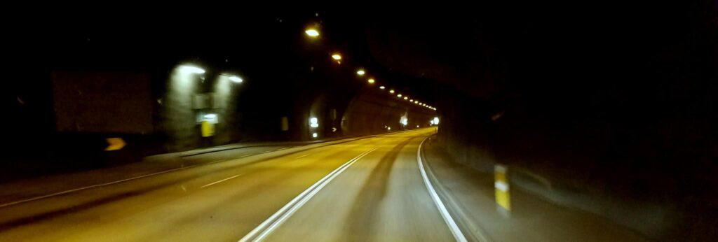
We drove back to Reykjavik by the same route, stopping in Borgarnes again for groceries for the next leg of our trip, and a few more skeins of yarn. This time we took the 6 km tunnel that runs under the mouth of the Hvalfjörður, shaving off some 30 miles and quite a bit of beautiful scenery.

Reykjavik lay under a bank of clouds as low and dark as ever, but the air was sparkling clear and you could see the Hallgrímskirkja on the high hill in the center of town, shaped exactly like the Kirkjufell, from twenty miles away, shining silver in a stray beam of sunlight.
Read more: Barb & Troy’s September 2018 Iceland Adventure
Happy Camping! #CamperStories


Iceland Travel Guides


If you like what you see, please subscribe to our YouTube channel!