

Iceland’s most famous attractions — the Golden Circle, the Blue Lagoon, and the Northern Lights — are famous for a reason. But if you’ve done your research, you already know they’re also crowded. Very crowded.
The good news? Iceland is packed with unique experiences, and most visitors barely scratch the surface. Hidden behind every ridge and down every gravel track, there are places that genuinely take your breath away — and you could have them entirely to yourself.
This guide pulls together 20+ off-the-beaten-path locations across the island, complete with directions, vehicle requirements, and travel tips so you can actually get there. Whether you’re planning a campervan trip, a 4×4 adventure into the Highlands, or just looking for detours off the Ring Road, this is your practical companion for experiencing a quieter, wilder side of Iceland.
Best Hidden Gems in Iceland: Quick List
- Reykjadalur Hot River
- Friðheimar Tomato Farm
- Kerið Crater
- Fjaðrárgljúfur Canyon
- Seljavallalaug Pool
- Glymur Waterfall
- Deildartunguhver
- Rauðisandur
- Dynjandi
- Ásbyrgi Canyon
- Hljóðaklettar
- Dimmuborgir
- Hofsós Pool
- Arctic Henge
- Stuðlagil Canyon
- Borgarfjörður Eystri
- Seyðisfjörður
- Stórurð
- Landmannalaugar
- Kerlingarfjöll
- Háifoss
- Þórsmörk
At a Glance: Which Hidden Gems Suit Your Trip?
- Best hidden gems for 2WD travelers
Reykjadalur, Kerið, Friðheimar, Hofsós, Seyðisfjörður, Dimmuborgir - Best hidden gems for 4×4 travelers
Þórsmörk, Landmannalaugar, Kerlingarfjöll, Háifoss - Best hidden gems near the Ring Road
Fjaðrárgljúfur, Stuðlagil, Dimmuborgir, Seyðisfjörður, Hofsós - Best hidden gems for hikers
Glymur, Reykjadalur, Stórurð, Landmannalaugar - Best hidden gems for campervan travelers
- Reykjadalur, Fjaðrárgljúfur, Dimmuborgir, Stuðlagil, Seyðisfjörður, Hofsós
Hidden Gems in Iceland Map
Use this map to see where each hidden gem is located and how they fit into a Ring Road, Westfjords, or Highlands itinerary. Some stops are easy detours from Route 1, while others require extra driving time, gravel-road confidence, or a 4×4.
Hidden Gems in Iceland by Region
South Iceland Hidden Gems
South Iceland may be home to some of the country’s most famous sights, but it also has plenty of quieter stops that many travelers drive right past. If you’re looking for hidden gems in Iceland, this region is one of the easiest places to start. You’ll find geothermal valleys, canyon hikes, lesser-known waterfalls, unusual food experiences, and scenic detours that feel far more personal than the usual South Coast checklist.
These are the kinds of places that work especially well on a self-drive campervan trip, with plenty of detours and overnight stops along the route. Some are easy detours from the Ring Road, while others are better suited to drivers with a little more time, a gravel-road-friendly vehicle, or a 4×4. For travelers who want non-touristy things to do in Iceland, South Iceland offers a strong mix of convenience and discovery.
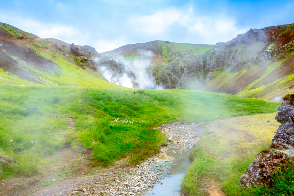
Reykjadalur Hot River
The trail to Reykjadalur — the ‘Smoking Valley’ — is one of those Iceland experiences that feels almost unreal. Steam rises from the earth, the smell of sulphur drifts across the valley, and after an hour’s hike through a geothermal landscape, you’re rewarded with a natural hot river where you can actually sit and soak.
The trailhead starts north of the village of Hveragerði, about 45 minutes from Reykjavík. You pass bubbling mud pools — some reaching 212°F (100°C), clearly signed with the Icelandic word ‘Hætta!’ (Danger!) — and rolling views of the valley before you reach the river. The lower stretch sits at a comfortable 100-104°F (38–40°C).
| Location | North of Hveragerði, South Iceland |
| Best for | Hikers, natural hot spring enthusiasts |
| Time needed | 3–4 hours (including hike and soak) |
| Difficulty | Moderate – approx 3km each way on a gravel path |
| Vehicle needed | Standard 2WD – accessible by any rental car or camper |
| Crowd level | Moderate – busier on sunny weekends, quieter on weekday mornings |
How to Get There
Drive to Hveragerði (Route 1, approx. 45 min from Reykjavík). The parking lot is on the north edge of town — the trail begins directly from there. It’s an easy stop to include on a campervan itinerary, especially if you’re starting or ending near Reykjavík.
Travel Tips
- There are no sanitary facilities at the river — plan accordingly
- The upper part of the river is hotter — test before lowering yourself in
- Bring a towel and a change of clothes in a dry bag

Friðheimar Tomato Farm
The Friðheimar Tomato Farm is one of those uniquely Icelandic experiences that surprises people in the best way. In the middle of a volcanic landscape, tomatoes are grown year-round using geothermal energy, inside glowing greenhouses filled with vines stretching up toward the glass ceiling. It’s warm, bright, and smells faintly of fresh herbs — a sharp contrast to the rugged scenery outside.
Instead of just visiting, you can sit down right inside the greenhouse and eat. The menu revolves around tomatoes in every form, from fresh soup served with homemade bread and tomato-based pasta, to more unexpected dishes like tomato ice cream and tomato apple pie. It’s simple, local, and genuinely memorable — especially if you’re looking for something a little different from Iceland’s usual natural attractions.
| Location | Reykholt (near Flúðir), Golden Circle area, South Iceland |
| Best for | Food lovers, couples, families, unique local experiences |
| Time needed | 1–2 hours (longer if you stay for a full meal) |
| Difficulty | Easy — no hiking required |
| Vehicle needed | Standard 2WD —easily accessible by any rental car or camper |
| Crowd level | Moderate — popular at lunch; quieter earlier or later in the day |
How to Get There
Drive along the Golden Circle route (Route 35) toward Reykholt. Friðheimar is clearly signposted and easy to access, about 1 hour and 30 minutes from Reykjavík.
Travel Tips
- Reservations are strongly recommended, especially during peak travel months
- Try the tomato soup — it’s the signature dish and a favorite for a reason
- Combine this stop with nearby Golden Circle sights like Gullfoss or Geysir
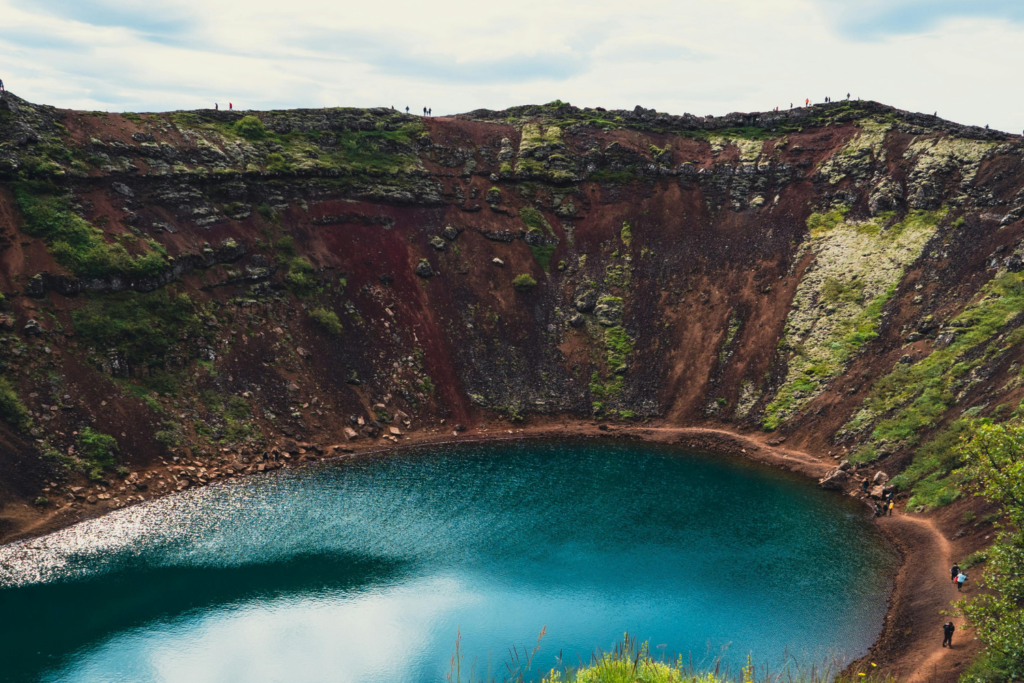
Kerið Crater
Kerið Crater is one of those stops that feels almost too perfectly shaped to be real. With its deep red volcanic slopes and bright blue lake at the center, it looks like a natural amphitheater — or, from above, something closer to a giant eye set into the earth.
Unlike many of Iceland’s older volcanoes, Kerið is relatively young, formed around 3,000 years ago. Scientists now believe it wasn’t created by a typical eruption, but by a volcano that emptied its magma chamber and collapsed in on itself. Over time, rain and groundwater filled the basin, creating the calm, aquamarine lake you see today. The water depth varies with rainfall and the season, but it is generally around 23 to 46 feet (7 to 14 meters) deep. The contrast between the red rock, green moss, and blue water makes it one of the most visually striking — and easy-to-reach — stops in South Iceland.
| Location | Grímsnes area, between Selfoss and Haukadalur, South Iceland |
| Best for | Photographers, road trippers, quick scenic stops |
| Time needed | 30–45 minutes |
| Difficulty | Easy — short, well-maintained walking paths around the rim and down to the lake |
| Vehicle needed | Standard 2WD — easily accessible by any rental car or camper |
| Crowd level | Moderate — can get busy midday, quieter early morning or evening |
How to Get There
Kerið is located just off Route 35 along the Golden Circle, about 15 minutes from Selfoss and 1 hour 15 minutes from Reykjavík. It’s clearly signposted and easy to find.
Travel Tips
- There is a small service fee (around $5.75/700 ISK) to access the crater
- Walk the full rim for the best views, then take the path down to the water’s edge
- Visit early or late in the day for fewer crowds and softer light
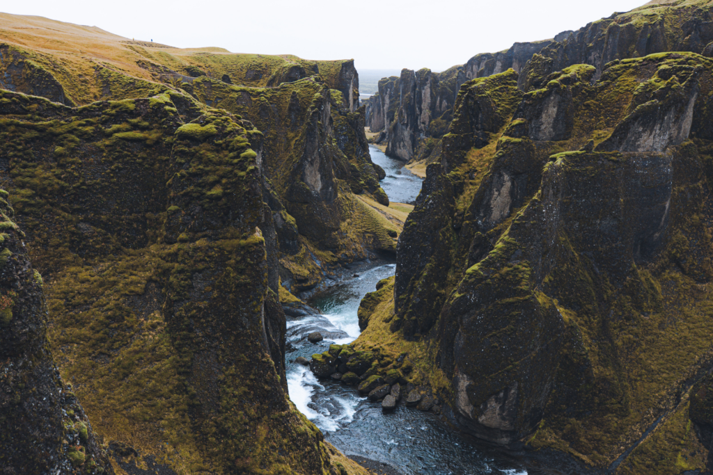
Fjaðrárgljúfur Canyon
Fjaðrárgljúfur Canyon is the kind of stop that makes a South Coast road trip feel much bigger than the main route. Its winding gorge, mossy cliffs, and deep river channel create one of the most memorable landscapes in the region.
Located just off the Ring Road near Kirkjubæjarklaustur in South Iceland, Fjaðrárgljúfur is one of the easiest dramatic detours on a South Coast road trip. It was formed thousands of years ago by glacial meltwater cutting through the rock, leaving behind the steep, serpentine gorge you see today. The walking path from the parking area leads to several viewpoints along the rim, making it an easy stop with a big payoff.
| Location | Near Kirkjubæjarklaustur, South Iceland |
| Best for | Photographers, road trippers, short scenic hikes |
| Time needed | 45 minutes–1.5 hours |
| Difficulty | Easy — short walking trail with some uneven ground |
| Vehicle needed | Standard 2WD — easily accessible by any rental car or camper |
| Crowd level | Moderate to high — quieter early in the morning or later in the evening |
How to Get There
From the Ring Road, turn onto Road 206 near Kirkjubæjarklaustur and follow it to the parking area. The canyon is about 8 km from the village and makes an easy detour from the South Coast route.
Travel Tips
- Stay on marked paths and viewing areas to help protect the fragile moss
- Wear sturdy shoes, especially if the trail is wet or muddy
- Visit early or late for softer light and fewer people
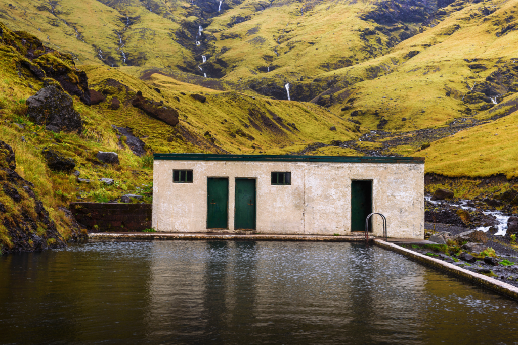
Seljavallalaug Pool
Seljavallalaug is one of Iceland’s oldest swimming pools, tucked away in a narrow valley beneath steep mountain slopes. Unlike the country’s polished geothermal spas, this one feels raw and a little forgotten — a concrete pool fed by a natural hot spring, surrounded by mossy cliffs and open sky.
Built in 1923, Seljavallalaug was once used for teaching locals how to swim. Today, it’s more of a quiet, off-the-beaten-path stop where you can soak in warm water while taking in the rugged landscape around you. The setting is what makes it special — a short walk through the valley leads you to a place that feels completely removed from the busy South Coast.
| Location | Near Seljavellir, between Seljalandsfoss and Skógafoss, South Iceland |
| Best for | Travelers looking for non-touristy experiences, photographers, short detours |
| Time needed | 45 minutes–1.5 hours |
| Difficulty | Easy — approx. 15–20 minute walk each way on a flat gravel path |
| Vehicle needed | Standard 2WD — easily accessible by any rental car or camper |
| Crowd level | Low to moderate — can be busier midday, quieter early morning or evening |
How to Get There
From the Ring Road, turn onto Road 242 (Raufarfellsvegur) and follow it to the small parking area at the end. From there, it’s a short walk into the valley — the pool is not visible from the parking lot but easy to find by following the path.
Travel Tips
- The water is warm, not hot — temperatures are usually around 86–97°F (30–36°C)
- The pool isn’t regularly cleaned, so water clarity can vary
- Basic changing shelter is available, but there are no proper facilities
- Respect the space — this is a quiet, local spot, not a full-service spa
West Iceland & Westfjords Hidden Gems
If South Iceland is about convenience, West Iceland and the Westfjords are where things start to feel truly remote. This is Iceland off the beaten path in the best possible way — fewer crowds, longer drives, and landscapes that feel untouched.
For travelers willing to go a bit further, this region offers some of the most rewarding hidden gems in Iceland. Expect dramatic coastlines, geothermal wonders, quiet fjords, and places where you might not see another traveler for hours.
Glymur Waterfall
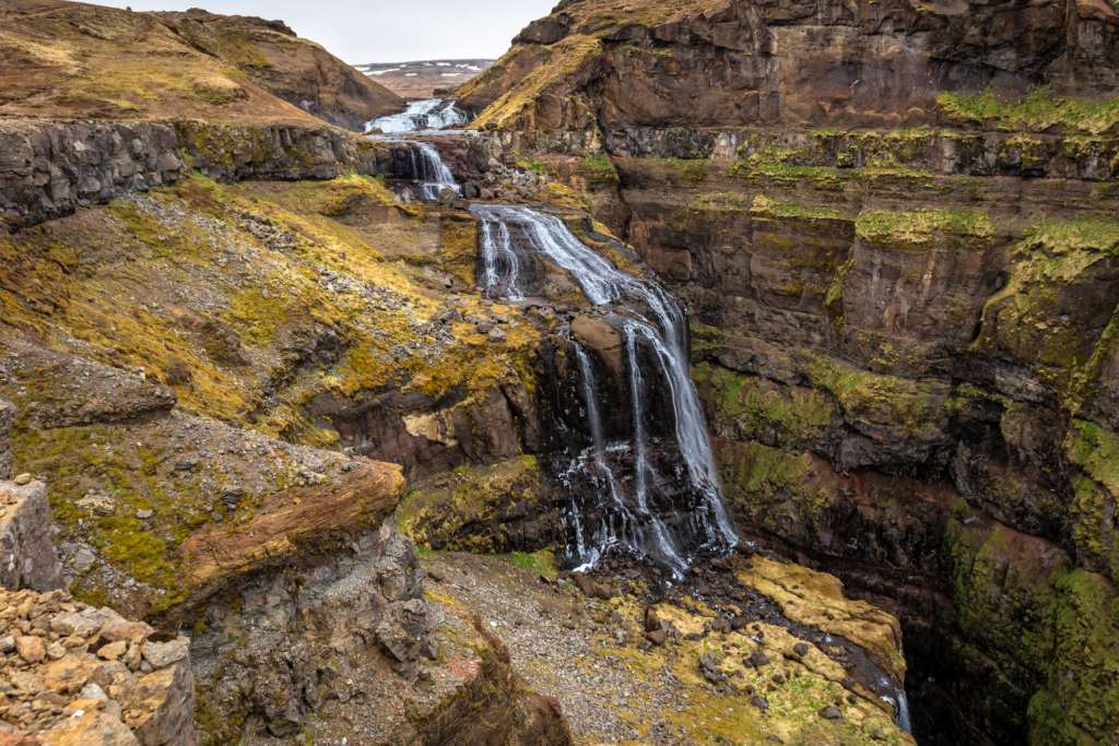
For travelers who enjoy a proper hike, Glymur is one of the most rewarding hidden gems in Iceland. The 198-meter waterfall lies deep in Hvalfjörður, or “Whale Fjord,” between Reykjavík and Borgarnes. Since the Hvalfjarðargöng tunnel opened in 1998, most drivers pass underneath the fjord instead of along it, leaving this route quieter and far less visited.
That quieter setting is part of Glymur’s appeal. The waterfall is also linked to Icelandic folklore. One local legend tells of an elf woman who turned her human husband into a whale after he refused to acknowledge their child. The whale, called Rauðhöfði because of the red cap he once wore, swam up the river and became trapped in the narrow gorge below the falls.
As he thrashed around, he was said to shake the earth itself — a possible link to the name Glymur, which is often associated with rumbling or trembling. The hike follows a dramatic canyon trail and climbs to sweeping views over the waterfall, making this one of the most memorable off-the-beaten-path stops in West Iceland.
| Location | Hvalfjörður, West Iceland (between Reykjavík and Borgarnes) |
| Best for | Hikers, adventure travelers, waterfall lovers |
| Time needed | 3–4 hours round trip |
| Difficulty | Moderate to challenging |
| Vehicle needed | Standard 2WD (parking area accessible) |
| Crowd level | Low to moderate — much quieter than South Coast waterfalls |
How to Get There
Drive north from Reykjavík on Route 1, then take Route 47 into Hvalfjörður. The hike starts near the end of the fjord.
Travel Tips
- The log bridge is usually removed in winter — check conditions before your visit
- Wear proper hiking shoes; the trail can be steep and slippery
Image alt text: Deildartunguhver Hot spring covered in a dusting of snow on a clear day
Deildartunguhver Hot Spring
Deildartunguhver might be a bit of a tongue twister, but it’s one of the most powerful hot springs in Europe and one of the more surprising hidden gems in Iceland. Around 180 liters of near-boiling water surge from the ground every second, reaching temperatures of up to 212°F (100°C).
This isn’t just a natural curiosity — it’s a working part of everyday life in West Iceland. The spring supplies hot water to nearby towns like Borgarnes and Akranes via a 40-mile (64 km) pipeline, and its geothermal energy is also used to heat greenhouses in the region, where tomatoes, cucumbers, and other produce are grown year-round.
While you can’t bathe directly in the spring, the nearby Krauma Baths offer a more relaxing way to experience it. Here, the hot water from Deildartunguhver is cooled with glacial water to create a range of pools at different temperatures, along with steam rooms and a quiet relaxation area.
| Location | Near Reykholt, West Iceland |
| Best for | Geothermal landscapes, quick stops, unique natural phenomena |
| Time needed | 20–40 minutes as a stop on a road trip (longer if visiting Krauma) |
| Difficulty | Easy |
| Vehicle needed | Standard 2WD |
| Crowd level | Low |
How to Get There
Located just off Route 50, about 1.5 hours from Reykjavík.
Travel Tips
- Stay behind barriers — the water is extremely hot
- Combine your visit with Hraunfossar and Barnafoss nearby
- Krauma is a quieter alternative to larger geothermal spas
Rauðisandur Red Sand Beach (Westfjords)
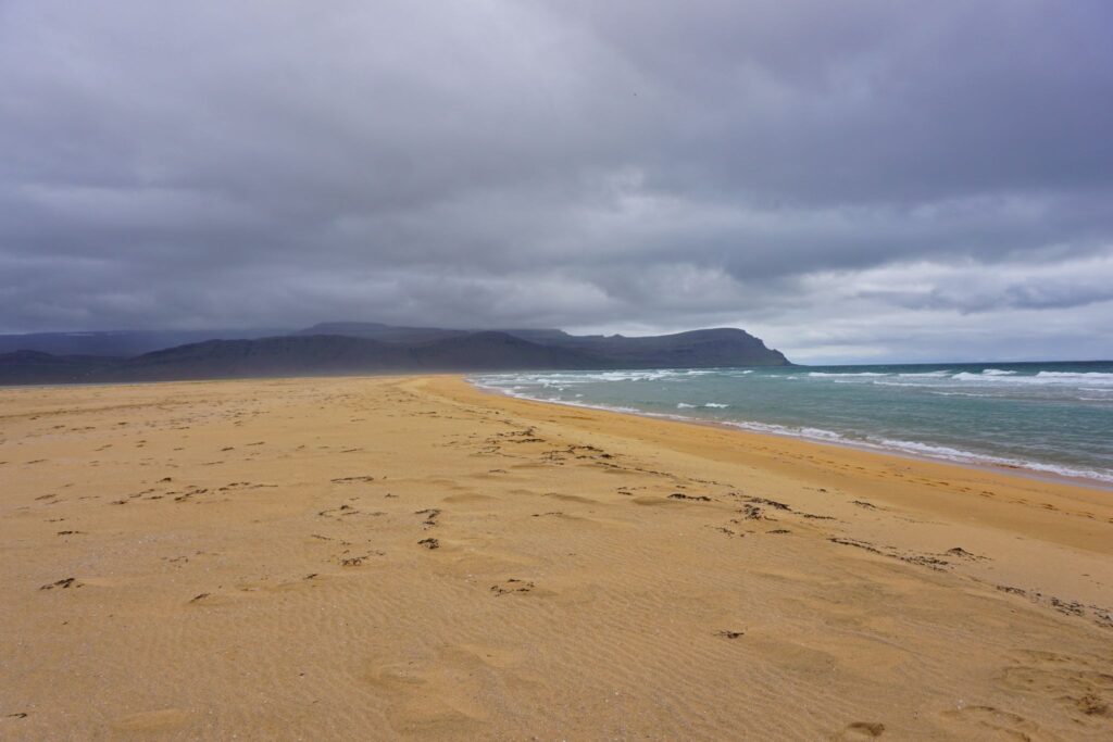
Black sand beaches may get most of the attention in Iceland, but Rauðisandur proves they are not the only coastal landscape worth seeking out. Stretching for around 6 miles (10 km) in the Westfjords, this wide, quiet beach shifts through shades of red, gold, orange, and even pink depending on the light and the weather.
Part of what makes Rauðisandur feel so special is its emptiness. Instead of dramatic crowds or busy viewpoints, you’ll find open shoreline, a sense of total stillness, and, if you are lucky, seals resting along the coast. It feels a world away from Iceland’s better-known beaches and is one of the best places to experience Iceland off the beaten path.
It also works well as part of a longer Westfjords detour. A little further along Road 612, the cliffs of Látrabjarg offer the chance to see puffins nesting there in summer. And if you want to avoid driving the full way around the Westfjords, taking the ferry from Stykkishólmur to Brjánslækur can make the route much more manageable.
| Location | Southern Westfjords |
| Best for | Photographers, scenic drives, solitude, wildlife spotting |
| Time needed | 1–2 hours |
| Difficulty | Easy |
| Vehicle needed | 2WD possible, 4×4 recommended for extra confidence on the gravel roads |
| Crowd level | Very low |
How to Get There
Drive via Route 612 from Brjánslækur or Patreksfjörður. Another option is to take the ferry from Stykkishólmur to Brjánslækur and continue by car from there.
Travel Tips
- The beach looks different depending on the light, so photography is especially rewarding in softer morning or evening conditions
- Combine it with Látrabjarg if you are visiting in puffin season
- Roads in this area can be rough and steep, so drive carefully and allow extra time
Dynjandi Waterfall
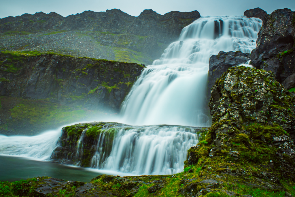
Dynjandi is often called the most beautiful waterfall in the Westfjords — and despite its size and beauty, it still feels relatively untouched compared to Iceland’s famous falls.
The waterfall fans out like a bridal veil, with several smaller cascades along the hike up.
| Location | Westfjords |
| Best for | Photographers, scenic hikes, iconic landscapes without crowds |
| Time needed | 1–1.5 hours |
| Difficulty | Easy to moderate (short uphill walk) |
| Vehicle needed | Standard 2WD (summer), 4×4 recommended in winter/shoulder seasons |
| Crowd level | Low |
How to Get There
Follow Route 60 through the Westfjords and watch for the clearly marked turnoff to Dynjandi. The waterfall sits close to the road, with a parking area at the base and a walking path leading uphill past several smaller cascades to the main falls.
Travel Tips
- Stop at each smaller waterfall on the way up
- The wind can be strong — dress in layers and bring a jacket
- One of the most rewarding stops in the Westfjords
North Iceland Hidden Gems
North Iceland just feels different from the south and west — wilder, quieter, and often overlooked by first-time visitors. While places like Lake Mývatn and Akureyri are well known, much of the region still feels like truly off-the-beaten-path Iceland.
This is where you’ll find volcanic landscapes, coastal villages, unusual rock formations, and some of the most unique experiences in Iceland — often without the crowds.
If you’re driving the Ring Road or planning a longer road trip, these stops are well worth adding to your route.
Ásbyrgi Canyon
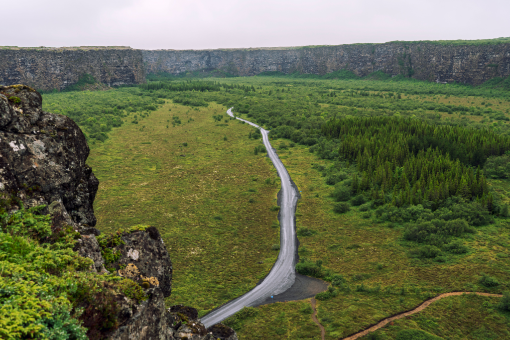
Ásbyrgi is one of the most unusual landscapes in Iceland — a vast, horseshoe-shaped canyon in Vatnajökull National Park in the northeast. Around 3.5 kilometers long, it is enclosed by towering cliffs, with a 25-meter rock formation rising from the middle like an island in the canyon floor.
Its shape has inspired one of the best-known pieces of Icelandic folklore. According to legend, Ásbyrgi was formed when Sleipnir, Odin’s eight-legged horse, placed one of his hooves on the earth. That story, combined with the canyon’s stillness and scale, gives the whole place an almost otherworldly feel.
There are several hiking trails through the area, leading past forested paths and small ponds, including Botnstjörn, a calm lake tucked beneath the cliffs. The acoustics here can feel strangely soft and echoing, which only adds to Ásbyrgi’s reputation as a place tied to hidden people, elves, and old Icelandic stories. For travelers looking for hidden gems in Iceland, this is one of the most atmospheric stops in the north.
| Location | Vatnajökull National Park, North Iceland |
| Best for | Easy hikes, folklore, peaceful nature |
| Time needed | 1–2 hours |
| Difficulty | Easy |
| Vehicle needed | Standard 2WD |
| Crowd level | Low to moderate |
How to Get There
From the Ring Road, follow Route 864 or Route 85 north toward the Dettifoss and Ásbyrgi area, then follow the signs into the canyon.
Travel Tips
- Combine it with Dettifoss or Húsavík (one of the best spots for whale watching) for a full day in North Iceland
- Walk beyond the first viewpoint to experience the canyon properly
- A great stop for travelers interested in Icelandic folklore as well as scenery
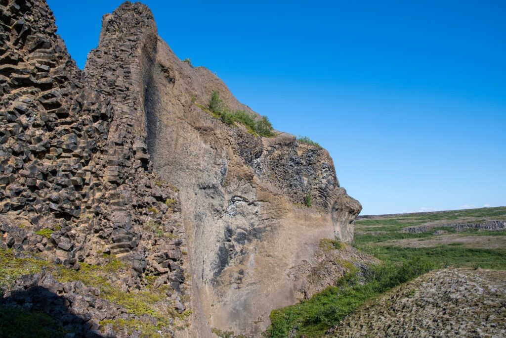
Hljóðaklettar (Echo Rocks)
Hljóðaklettar is one of the most unusual and least-visited natural areas in North Iceland. Known as the “Echo Rocks,” this cluster of basalt formations creates strange acoustics — sounds bounce and travel in unexpected ways through the rock formations.
The area is filled with hexagonal columns, caves, and twisting lava shapes formed by ancient volcanic activity and glacial floods. It’s a quiet place to explore on foot, with marked trails leading through formations that feel almost sculpted.
| Location | Jökulsárgljúfur area, Vatnajökull National Park, North Iceland |
| Best for | Geology, short hikes, and unique landscapes |
| Time needed | 1–2 hours |
| Difficulty | Easy to moderate |
| Vehicle needed | Standard 2WD |
| Crowd level | Very low |
How to Get There
From the Ring Road, take Route 862 or 864 toward Dettifoss, then follow signs to Hljóðaklettar.
Travel Tips
- Try clapping or speaking near the rock formations to hear the echoes
- Combine with Ásbyrgi or Dettifoss for a full-day route
- Bring sturdy shoes — some paths are uneven
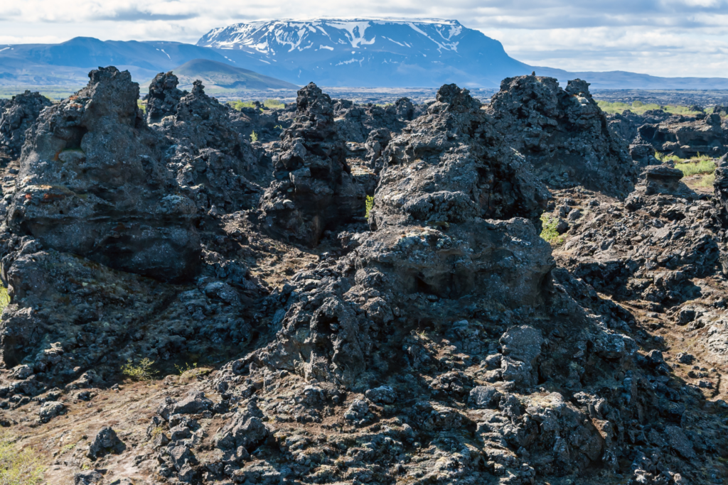
Dimmuborgir Lava Field
Dimmuborgir — often translated as “dark castles” — is one of the most surreal places in Iceland. The lava formations here look like crumbling towers, arches, and ruins, shaped by volcanic activity thousands of years ago.
Walking through the area feels a bit like stepping into a fantasy landscape. According to Icelandic folklore, this is one of the homes of trolls and elves — and in winter, it’s also said to be where the Yule Lads live.
There are several marked walking paths, making it easy to explore at your own pace while taking in the strange and dramatic rock formations.
| Location | Near Lake Mývatn, North Iceland |
| Best for | Short walks, photography, and unique landscapes |
| Time needed | 1–2 hours |
| Difficulty | Easy |
| Vehicle needed | Standard 2WD |
| Crowd level | Moderate (quieter than major South Coast sites) |
How to Get There
Located just east of Lake Mývatn, well signposted from the Ring Road.
Travel Tips
- Choose longer walking loops for fewer crowds
- Combine with other Mývatn stops like Hverir or Grjótagjá
- Great in winter for a more atmospheric experience
Hofsós Infinity Pool
Not every hidden gem in Iceland is a wild natural site. In the small town of Hofsós on the Tröllaskagi Peninsula, you’ll find one of the country’s most scenic swimming pools, perched on a hillside with wide views over the sea and the mountains across the fjord.
The setting is what makes it memorable. The warm water, usually around 30°C (86°F), feels especially inviting in cool or windy weather, and the pool’s edge seems to blend straight into the landscape beyond. It is a simple stop, but one that feels calm, local, and far removed from Iceland’s larger geothermal spas.
Right next to the pool, a short path leads down to the shoreline, where you can see a striking basalt stone wall below. And if you are continuing along Route 76, Viðimýrarkirkja — one of Iceland’s best-known turf churches — makes a worthwhile nearby detour, even if you are only stopping briefly to see the setting.
| Location | Hofsós, Tröllaskagi Peninsula, North Iceland |
| Best for | Relaxation, scenic views, non-touristy experiences |
| Time needed | 45 minutes to 1 hour (longer if you choose to head to the coast) |
| Difficulty | Easy |
| Vehicle needed | Standard 2WD |
| Crowd level | Low |
How to Get There
Drive along Route 76 on the Tröllaskagi Peninsula. Hofsós is a small coastal village, and the pool is easy to find once you arrive.
Travel Tips
- Bring swimwear and a towel
- Walk down to the beach after your swim for a different view of the coastline
- Pair it with a stop at Viðimýrarkirkja if you are exploring the peninsula by car
Arctic Henge (Heimskautsgerðið)
In the remote village of Raufarhöfn, near the northern edge of Iceland, you’ll find one of the country’s most unexpected landmarks. The Arctic Henge is a modern stone monument inspired by Norse mythology and designed to align with the sun.
Set against a wide, open landscape, it feels especially atmospheric in the Midnight Sun or under the Northern Lights. With very few visitors making it this far, it’s one of the best places for a truly quiet, off-the-beaten-path experience.
| Location | Raufarhöfn, far North Iceland |
| Best for | Photography, solitude, and unique experiences in Iceland |
| Time needed | 30–60 minutes |
| Difficulty | Easy |
| Vehicle needed | Standard 2WD (long drive required) |
| Crowd level | Very low |
How to Get There
Drive north from the Ring Road via Route 85 or 870 toward Raufarhöfn.
Travel Tips
- Great spot for Midnight Sun or Northern Lights photography
- Combine with a wider North Iceland road trip — it’s a long detour
- Bring supplies — services are limited in this area
East & Northeast Iceland Hidden Gems
East and Northeast Iceland are often skipped by travelers short on time, which is exactly why they offer some of the best hidden gems in Iceland. This is where the Ring Road starts to feel quieter, the landscapes more remote, and the experiences more personal.
You’ll find dramatic fjords, rugged coastlines, geothermal areas, and small towns where tourism feels secondary to everyday life. For travelers looking for non-touristy things to do in Iceland, this region delivers some of the most authentic and least crowded stops in the country.
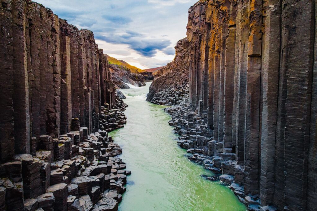
Stuðlagil Canyon
Stuðlagil Canyon has quickly become known for its striking basalt columns and bright blue glacial river — but compared to Iceland’s more famous sights, it still feels quieter than many of Iceland’s better-known natural attractions.
On one side, you get an elevated viewpoint; on the other, a longer walk leads you down into the canyon itself, where you can stand right beside the water and towering basalt formations. The contrast of colors — dark columns and vivid blue water — makes it one of the most photogenic spots in Iceland.
| Location | Jökuldalur Valley, East Iceland |
| Best for | Photography, unique landscapes, short hikes |
| Time needed | 1.5–2.5 hours |
| Difficulty | Easy to moderate (depending on access side) |
| Vehicle needed | 2WD for main access; gravel road conditions vary |
| Crowd level | Low to moderate |
How to Get There
From the Ring Road, turn onto Route 923 toward Jökuldalur. Follow signs to the east-side parking area for the main access trail. Stuðlagil is a popular addition to campervan itineraries in East Iceland, thanks to its proximity to Route 1.
Travel Tips
- The east side offers the best access to the canyon floor
- Water color varies depending on glacial runoff
- Allow extra time for the walk if you want the full experience
Borgarfjörður Eystri
If you’re looking for Iceland off the beaten path, Borgarfjörður Eystri is one of the best places to go. This remote fjord in East Iceland is known for its quiet atmosphere, dramatic coastal scenery, and strong connection to Icelandic folklore.
It’s also one of the most reliable places in Iceland to see puffins up close during the summer months, with well-maintained viewing platforms that let you get surprisingly close without disturbing them.
| Location | East Iceland, north of Egilsstaðir |
| Best for | Wildlife, solitude, scenic drives |
| Time needed | Half a day |
| Difficulty | Easy |
| Vehicle needed | Standard 2WD possible, though roads can be narrow and winding |
| Crowd level | Low |
How to Get There
Drive from Egilsstaðir via Route 94. The road is paved but includes steep sections and sharp turns.
Travel Tips
- Visit in summer for puffins
- Drive carefully — roads are narrow in places
- Take time to explore the small village and the surrounding trails
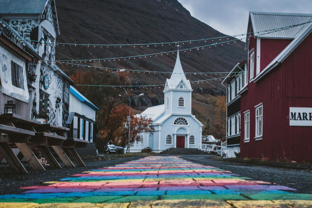
Seyðisfjörður
Seyðisfjörður is one of the most distinctive small towns in Iceland, set at the end of a narrow fjord and surrounded by steep mountains and waterfalls.
Known for its colorful wooden houses and creative atmosphere, it offers a different kind of hidden gem — less about dramatic natural features, and more about culture, scenery, and a slower pace of travel.
| Location | East Iceland, near Egilsstaðir |
| Best for | Scenic drives, culture, relaxed exploration |
| Time needed | 1–2 hours |
| Difficulty | Easy |
| Vehicle needed | Standard 2WD possible |
| Crowd level | Low to moderate |
How to Get There
From Egilsstaðir, drive Route 93 over the mountain pass into Seyðisfjörður.
Travel Tips
- The drive over the pass is part of the experience
- Stop for waterfalls along the way (Gufufoss and Budareyrarfoss)
- Walk through town to see the colorful streets and harbor
Stórurð (The Giant Boulders)
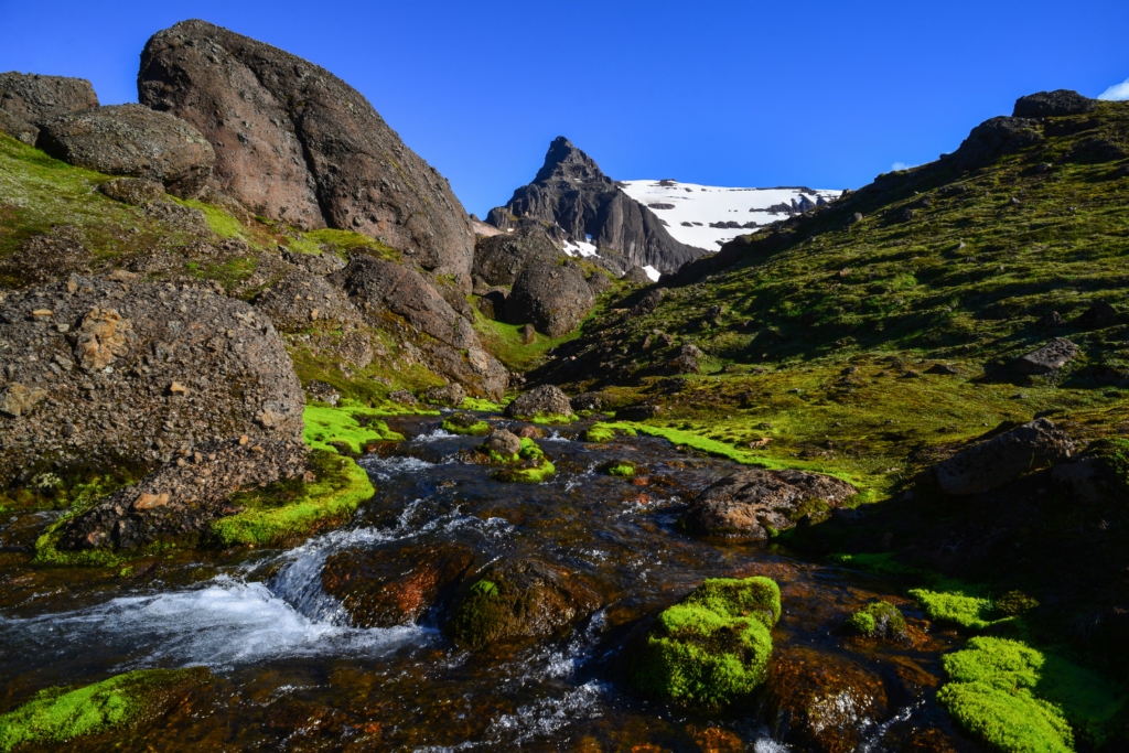
Stórurð is one of Iceland’s most surreal landscapes — and still one of its best-kept secrets. Hidden beneath the Dyrfjöll mountains in East Iceland, this area is filled with enormous moss-covered boulders scattered across a valley, with clear turquoise pools weaving between them.
The scale is hard to grasp until you’re there. Some of the rocks are the size of houses, creating a landscape that feels almost unreal — somewhere between a glacier valley and a natural sculpture field.
Reaching Stórurð requires a hike, which keeps visitor numbers low and helps preserve its quiet, untouched atmosphere. For travelers looking for truly non-touristy things to do in Iceland, this is one of the most rewarding experiences in the east.
| Location | Near Borgarfjörður Eystri, East Iceland |
| Best for | Hiking, photography, unique landscapes |
| Time needed | 4–6 hours (round-trip hike) |
| Difficulty | Moderate to challenging |
| Vehicle needed | 2WD to trailhead (road conditions vary) |
| Crowd level | Very low |
How to Get There
Drive toward Borgarfjörður Eystri via Route 94. Trailheads are located before reaching the fjord, with marked hiking routes leading into the valley.
Travel Tips
- Choose your route carefully — several trail options exist with varying difficulty
- Weather can change quickly in the mountains — bring layers and navigation
- Start early to allow plenty of time and avoid rushing the hike
Iceland Highlands Hidden Gems
If you’re looking for the most remote and untouched parts of the country, the Icelandic Highlands are where you’ll find them. This is Iceland off the beaten path in its purest form — vast volcanic landscapes, geothermal valleys, glacial rivers, and long stretches of road where you may not see another car for hours.
Unlike the rest of the country, the Highlands are only accessible for a short window in summer, and most routes are reached via F-roads — Iceland’s mountain roads, marked with an “F” on maps. These roads are often unpaved, rough, and can include river crossings. By law, F-roads are only open to 4×4 vehicles, and driving them in a standard car is both illegal and unsafe.
For those prepared with the right vehicle and a bit of planning, the reward is a completely different side of Iceland — quieter, wilder, and far more unpredictable. These hidden gems are not quick roadside stops, but true adventures, and some of the most unique experiences Iceland has to offer.
Landmannalaugar
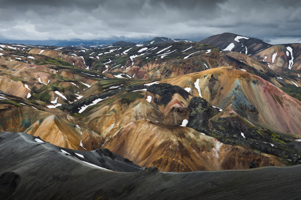
Landmannalaugar is one of the most unique landscapes in Iceland, known for its colorful rhyolite mountains, steaming geothermal vents, and natural hot springs. While it’s becoming more popular, it still feels remote compared to most destinations — especially if you venture beyond the main areas.
The contrast of orange, red, green, and black mountains makes this one of the most visually striking places in the Highlands. After a hike, you can soak in a natural hot pool surrounded by raw volcanic terrain — one of the most memorable unique experiences in Iceland.
| Location | Fjallabak Nature Reserve, Highlands |
| Best for | Hiking, geothermal landscapes, photography |
| Time needed | Half day to full day |
| Difficulty | Easy to challenging (depending on hikes) |
| Vehicle needed | 4×4 required (F-roads) |
| Crowd level | Moderate (quieter early/late in the day) |
How to Get There
Access via the F208 or F225. Both routes include rough terrain, and river crossings are common depending on conditions.
Travel Tips
- Always check road conditions on road.is before heading out
- Bring a swimsuit for the hot spring
- Weather can change quickly — pack layers
Kerlingarfjöll
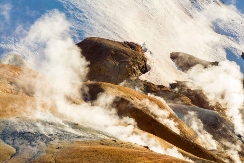
Kerlingarfjöll is one of the Highlands’ most underrated destinations — a geothermal mountain range filled with steaming valleys, colorful hills, and quiet hiking trails.
The main highlight is Hveradalir, a geothermal area where steam rises from the ground, and mineral deposits paint the landscape in shades of orange and red. Compared to more famous geothermal sites, it feels far less crowded and more immersive.
| Location | Central Highlands, between Gullfoss and Kjölur route |
| Best for | Hiking, geothermal exploration, photography |
| Time needed | Half day to full day |
| Difficulty | Moderate |
| Vehicle needed | 4×4 required (F35 / access roads) |
| Crowd level | Low to moderate |
How to Get There
Drive the Kjölur route (F35), then follow the access road into Kerlingarfjöll. Road conditions vary, but a 4×4 is required.
Travel Tips
- Hike into Hveradalir for the best scenery
- Great alternative to more crowded geothermal areas
- Accommodation is available if you want to stay overnight
Háifoss Waterfall
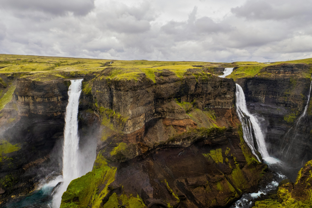
Háifoss is one of the tallest waterfalls in Iceland, dropping dramatically into a deep canyon — yet it remains far less visited than similar waterfalls elsewhere in the country.
The setting is what makes it special. You’re standing at the edge of a vast, open landscape, looking down into a canyon where the waterfall plunges into the river below. Nearby, you’ll also see Granni waterfall, adding to the scale of the view.
| Location | Near Þjórsárdalur Valley, outskirts of the Highlands |
| Best for | Photography, scenic viewpoints, dramatic landscapes |
| Time needed | 45–60 minutes |
| Difficulty | Easy (short walk from parking) |
| Vehicle needed | 4×4 recommended (access road conditions vary) |
| Crowd level | Low |
How to Get There
From Route 32, turn onto Road 332 toward Haifoss. The final stretch is a rough gravel road.
Travel Tips
- Drive slowly, the road can be uneven and bumpy
- Stay well back from cliff edges; there are no barriers
- Combine with Þjórsárdalur Valley for a longer trip
Þórsmörk (Thórsmörk)
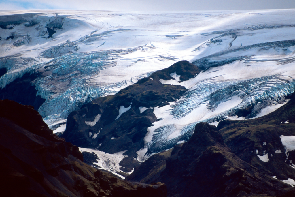
Ready for an unexpected Icelandic landscape? Instead of black sand and open plains, you’ll find a lush, green valley surrounded by glaciers, rugged mountains, and braided rivers cutting through the landscape at Þórsmörk.
Named after the Norse god Thor, this protected nature reserve sits between three glaciers — Eyjafjallajökull, Mýrdalsjökull, and Tindfjallajökull — creating a unique microclimate where vegetation thrives. It’s one of the best places in Iceland for hiking, with trails ranging from short scenic walks to sections of the famous Laugavegur route. The sense of isolation and scale make it feel like a true escape from the more traveled parts of the South Coast.
| Location | Þórsmörk Valley, Highlands (accessible from South Iceland) |
| Best for | Hikers, nature lovers, adventurous travelers, 4×4 road trips |
| Time needed | Half day to full day (longer if hiking or staying overnight) |
| Difficulty | Moderate to challenging — depending on hikes and access route |
| Vehicle needed | 4×4 only |
| Crowd level | Low to moderate — busy in peak hiking season, but still feels remote |
How to Get There
Þórsmörk is reached via F-roads from the South Coast, typically F249. The route includes multiple river crossings, which can be deep and unpredictable. If you’re not experienced with river driving, it’s best to take a guided transfer or Highland bus from the capital.
Travel Tips
- A proper 4×4 is essential — standard vehicles are not suitable
- Check road and river conditions before setting out (they can change daily)
- Weather can shift quickly in the Highlands — pack layers and waterproof gear
- Consider staying overnight to fully experience the area without rushing
Hidden Gems Near the Ring Road
If you want to explore Iceland off the beaten path without heading deep into the Highlands, the Ring Road still gives you access to plenty of quieter and more memorable stops. Many of these hidden gems are reachable with a standard 2WD rental car or campervan and work well as additions to a 7-day, 10-day, or full-circle self-drive itinerary.
Use this map to see which hidden gems fit most naturally into a Ring Road route, from South Coast detours to quieter stops in North and East Iceland.
When to Visit Iceland’s Hidden Gems
Not all hidden gems in Iceland are accessible year-round, and timing your trip makes a big difference. Summer (June–August) offers the best access, especially for the Highlands and F-roads, which are only open for a short season.
Spring and autumn can be great for fewer crowds and a quieter experience, but weather and road conditions are more variable. In winter, many remote areas (particularly in the Highlands) are completely inaccessible, but you can still visit plenty of hidden gems closer to the Ring Road.
If you’re planning your trip, it’s worth reading our full guides on the best time of year to visit Iceland and Iceland weather by month to choose the right season.
How to Plan a Hidden Gems Road Trip in Iceland
The best way to experience Iceland’s hidden gems is with a flexible self-drive itinerary. Some places are easy detours from Route 1, while others require extra driving time, gravel-road confidence, or a 4×4 for Highland access. Before setting out, check road conditions, daylight hours, and weather forecasts, and avoid trying to fit too many stops into one day. In Iceland, shorter daily driving distances usually lead to a much better trip.
Choosing the right vehicle also makes a big difference. A campervan is one of the most flexible ways to explore Iceland’s hidden gems, allowing you to stay closer to nature and adjust your route as you go. If you’re sticking to the Ring Road, a standard camper is enough for many of the places in this guide. For more remote areas — especially the Highlands — a 4×4 camper gives you the freedom to go further off the beaten path.
FAQs About Hidden Gems in Iceland
Do you need a 4×4 for Iceland’s hidden gems?
Not always, but for some of the most remote places, yes. Many hidden gems, especially in the Highlands, are reached via F-roads, which are only open in summer and legally require a 4×4 vehicle. These roads are often rough, unpaved, and may include river crossings.
That said, many hidden gems in South, West, and North Iceland (including Reykjadalur, Kerið, and Hofsós) are easy to reach with a standard 2WD rental car.
If you want more flexibility and access to remote areas, a 4×4 is the better choice.
When is the best time to visit Iceland’s hidden gems?
Summer offers the easiest access, especially for the Highlands, gravel roads, and remote hiking areas. Spring and autumn are great for fewer crowds, while winter is best for more accessible hidden gems near the Ring Road.
Is a campervan a good way to explore Iceland’s hidden gems?
Yes — especially for Ring Road trips. Campervans offer flexibility and make it easier to reach quieter locations without rushing. For Highlands routes, a 4×4 camper is required.
Do you need to hike to reach some of Iceland’s hidden gems?
Some of the best hidden gems involve short to moderate hikes, such as Reykjadalur, Glymur, and Stórurð. However, many others are easy to access with little or no walking required. In general, the more effort it takes to reach a place, the fewer people you’re likely to encounter there.
How long do you need to visit Iceland’s hidden gems?
A 7–10 day trip allows you to explore a good mix of hidden gems around the Ring Road. If you want to include the Westfjords or Highlands, you’ll need more time and a more flexible itinerary.
Explore Iceland Beyond the Usual Stops
Whether you are planning an easy Ring Road itinerary or a full 4×4 Highlands adventure, exploring Iceland’s hidden gems is one of the best ways to see a quieter, more memorable side of the country.